February 2010 - I walked the South Coast track from Melalauca to Cockle Creek. Originally I planned this as one walk, the Port Davey track followed by the South Coast track. However I was way too ambitious, the report on the Port Davey track walk that I did the previous year is here.

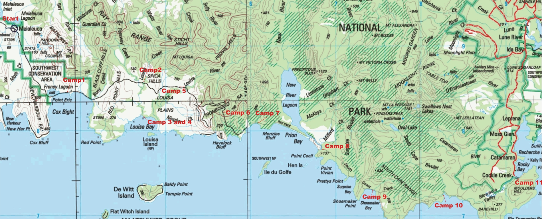
I spent 11 days walking From Melaluca to Cockle Creek along South-West Tasmania's South Coast track. (click map for larger scale map) |
|
|
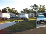
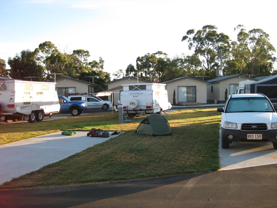
dwarfed by the Caravans at Hobart Airport Tourist Park (click on picture for larger version) |
Day 0 : I arrived at Hobart Airport on a Sunday afternoon. I could not get a flight from Adelaide that arrived in Hobart early enough to catch the Par Avion flight to Melaleuca. So I had to stay the first night in Hobart. I walked from the airport about one kilometre and camped at the Hobart Airport Tourist park. Taking up a spot normally reserved for a large Caravan I put my small hiking tent. The campsite is only about 500 metres from Cambridge Airport and Par Avion. There is a good camp kitchen at the tourist park. There are no food outlets around, other than a service station nearby that has some basics (including matches you might need when bushwalking).
|
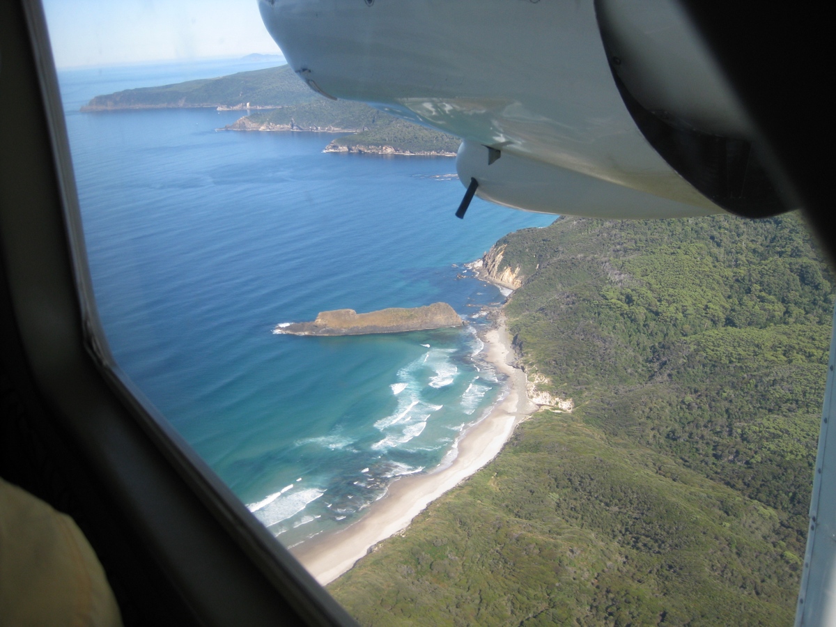
| Day 1: Flying out from Hobart with Par Avion to Melaleuca |
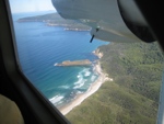 In the plane flying towards Melaleuca. Lion Rock towards the end of the South Coast Track. It was interesting to fly over what I would be waking along the next 11 days.(click for larger picture) In the plane flying towards Melaleuca. Lion Rock towards the end of the South Coast Track. It was interesting to fly over what I would be waking along the next 11 days.(click for larger picture)
|
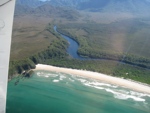
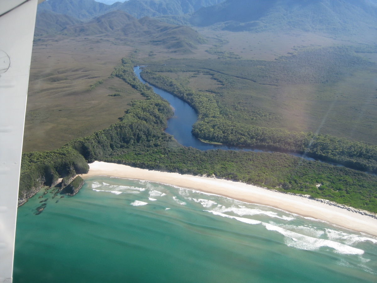
Louisa Bay from the plane. I would camp here for two days later in the walk.. |
|
|
|
|
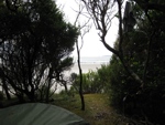
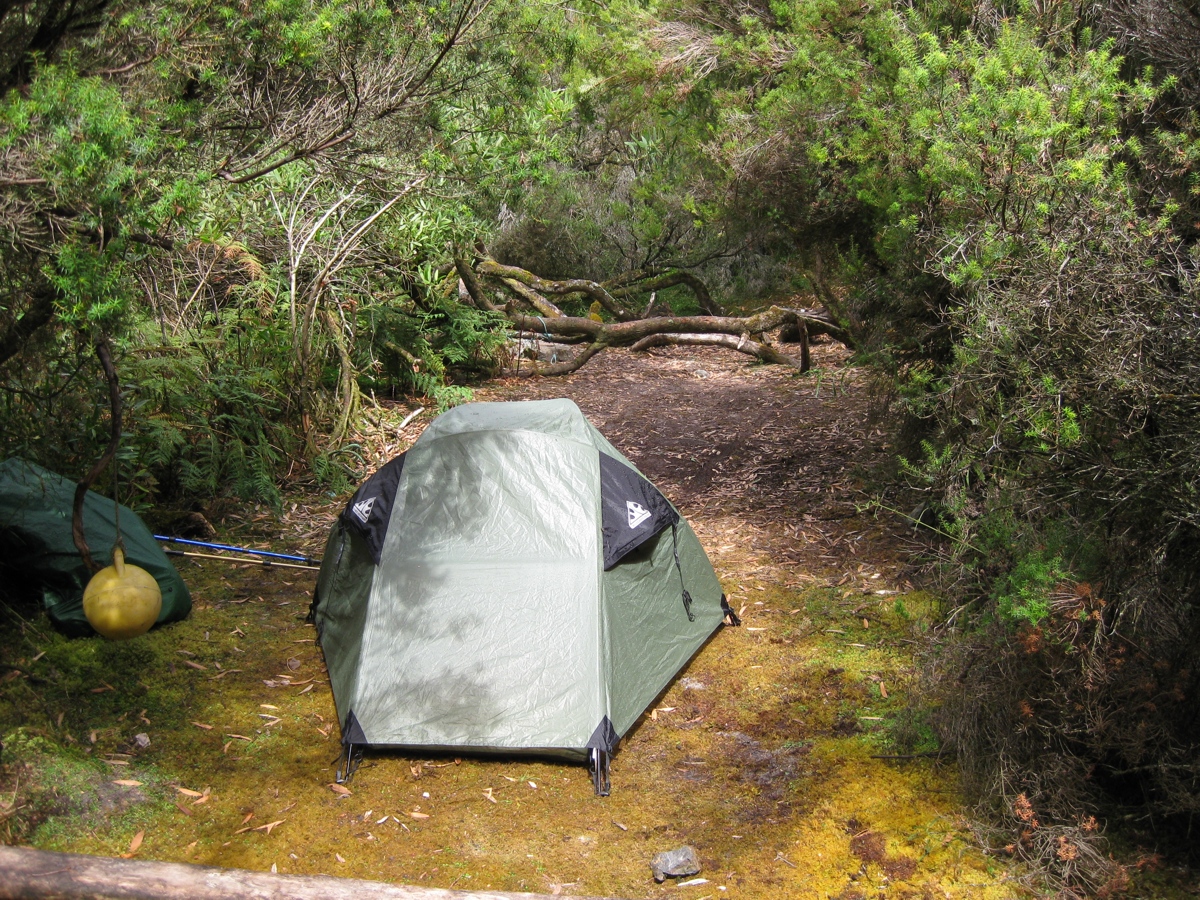
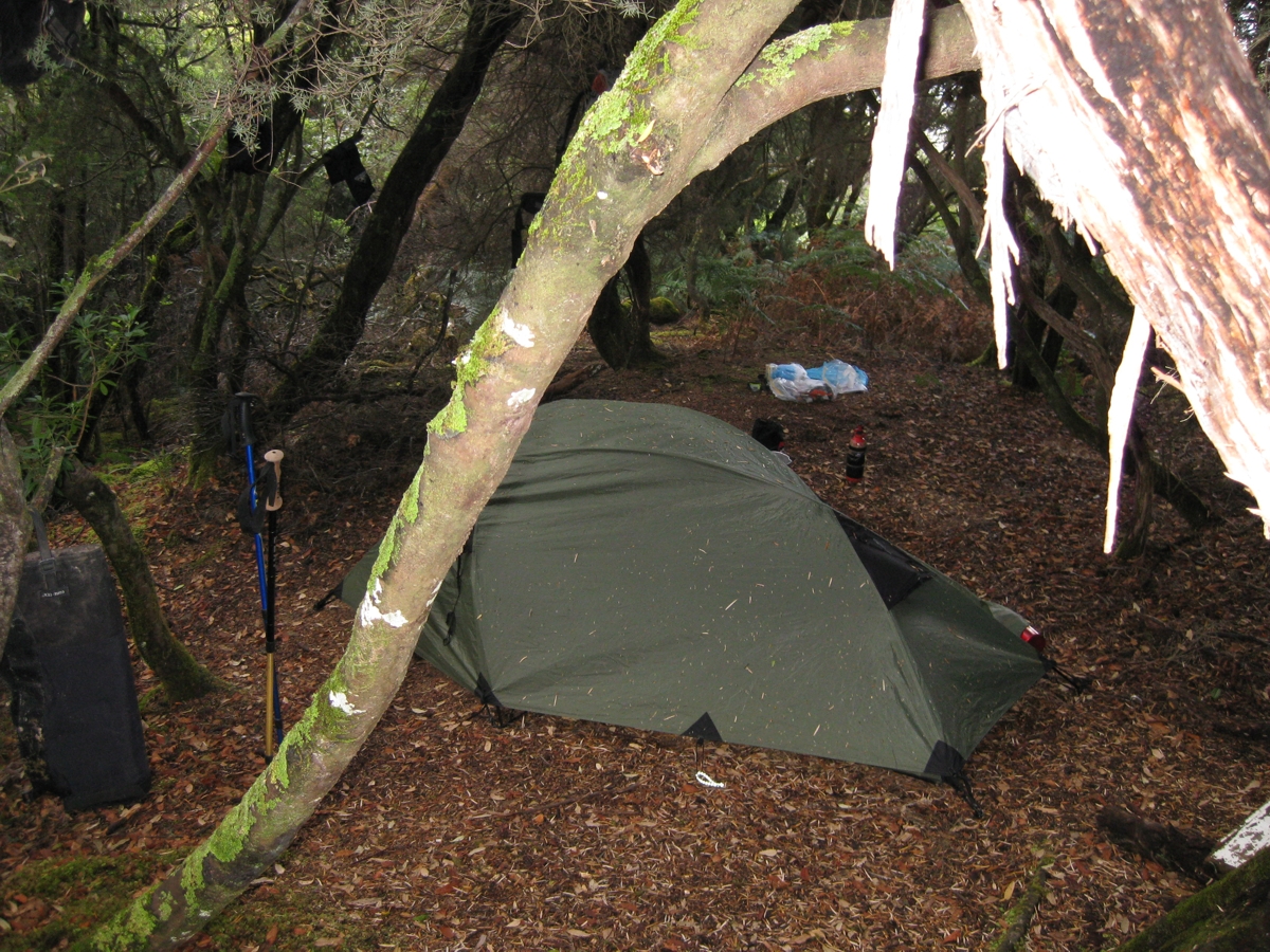
Day 1 : Melaleuca to Cox Bight. After a great flight out of Hobart in great weather I arranged my gear and headed south out of Melaleuca. It was the third time I had done the stretch of the South Coast track from Melaleuca to Cox Bight (I had never gone beyond Cox Bight). Weather was excellent, blue sky and not too warm. I found a nice secluded campsite just west of Point Eric, big enough to fit my small Dart hiking tent
|
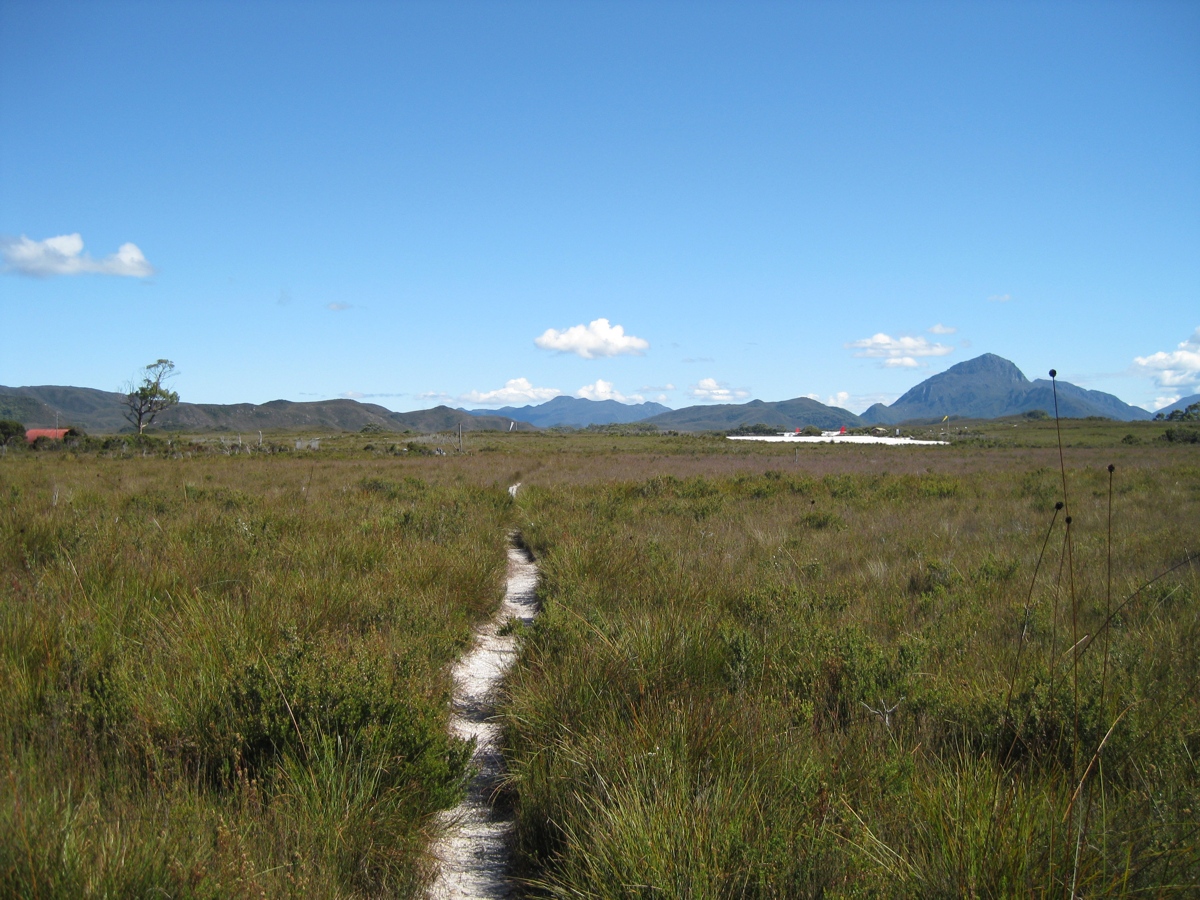
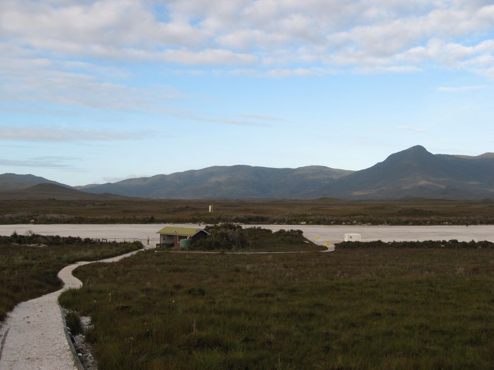
| The South Coast Track track leaving Melaleuca. Looking north you can see the Melaleuca airstrip. (click picture for larger version) |
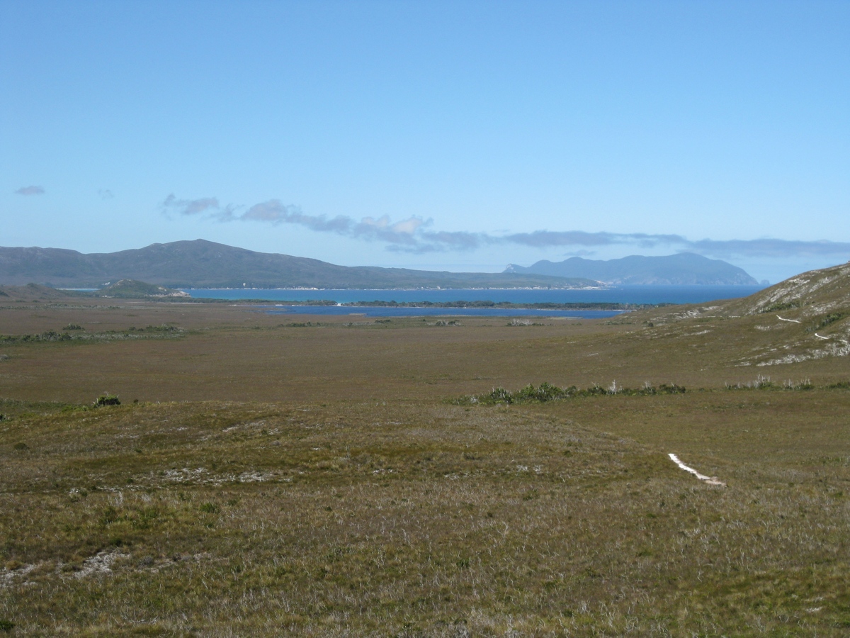
 Looking south towards Cox Bight, the South Coast track in the foreground, and you can see the lagoon behind the beach at Cox Bight. (click for larger picture) Looking south towards Cox Bight, the South Coast track in the foreground, and you can see the lagoon behind the beach at Cox Bight. (click for larger picture)
|
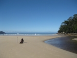
View from campsite on Cox Bight . (click for larger picture) |
|
|
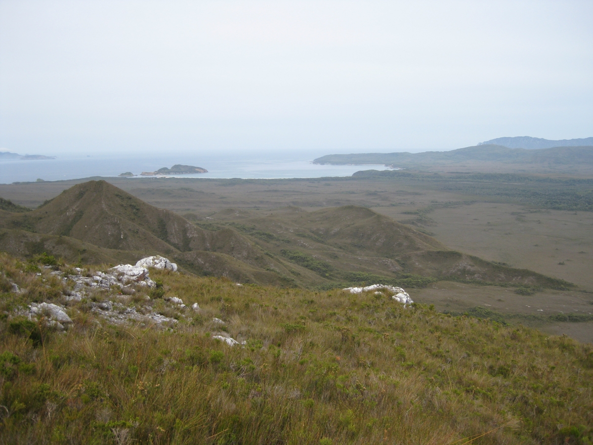
Day 2 : Cox Bight to Louisa Creek. Another nice day. I made my way along Cox Bight. I crossed over Point Eric. Everyone had left camp by the time I got there. I am very slow to get going in the morning, which I blame on making porridge!. Found the buoys at Buoy creek marking the point that the track leaves Cox Bight and heads up Red Point Hills. I found the climb over Red Point Hills difficult. It was not enough training, or not enough breakfast or something. It took a long time, and I wondered how I was going to go climbing over the Ironbounds. I had lunch at the top of Red Point Hills with a view of the Ironbounds in the distance. I met two tough looking bushwalkers coming the other way (heading west) who had come down from Precipitous Bluff and then waded through the side of New River Lagoon.
I was tired and originally aiming to get to Louisa Bay at the end of Day 2, however at Louisa Creek I gave up and camped.
|
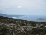
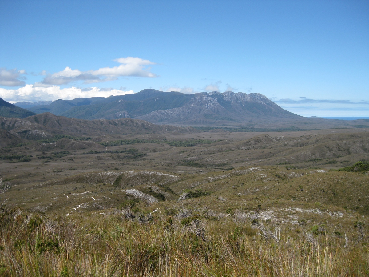
| (above) A view of the Ironbound Range in the distance from Red Point Hills, overlooking the Louisa Plains (click for enlarged picture) |
The crossing at Faraway Creek, on the Louisa Plains, west of Louisa Creek. (click for larger picture) |
|
|
Day 3 : Louisa Creek to Louisa Bay. The day was overcast and occasionally raining. It was not a long walk to Louisa Bay. It was however a steep decent down the cliff from the plains to the beach. The path had been made much safer with ropes (washed up?) strung along the path. When I got down to the campsite behind the beach, I found three other bushwalkers were packing up in the rain ready to head out. When they left I did not see anyone else for two days.
|
|
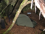
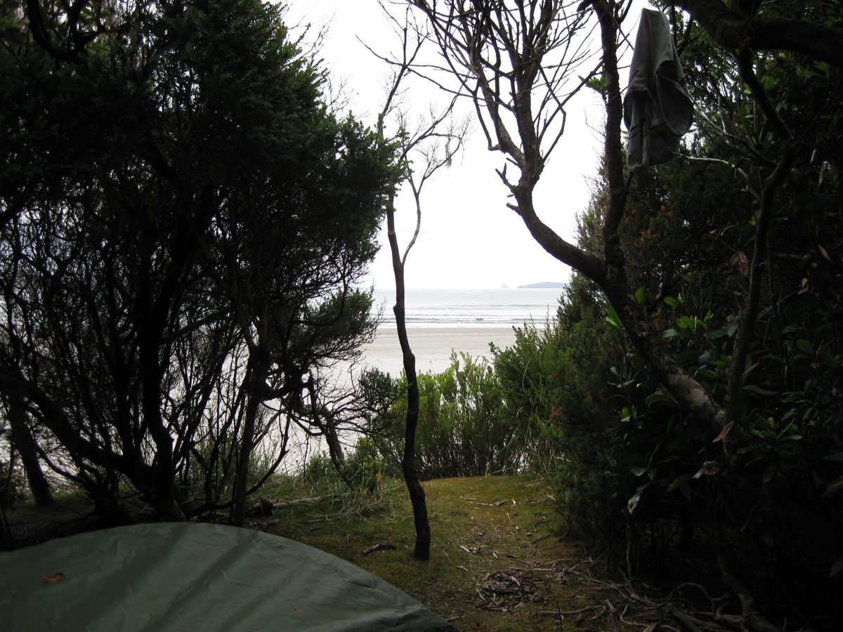
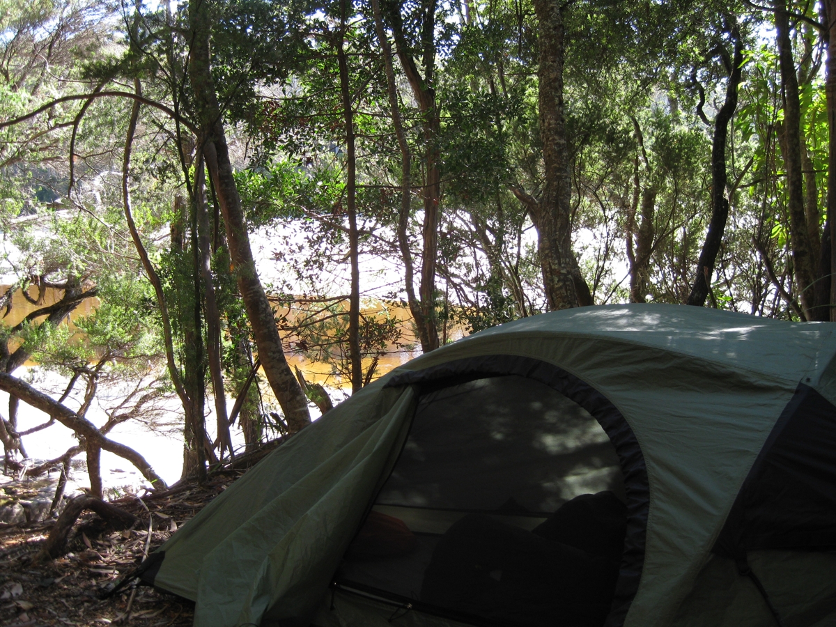
| (above) My campsite at Louisa Bay. It was well sheltered. (click for enlarged picture) |
Louisa Bay on the first day I camped. It was cold and overcast, and windy. (click for larger picture) |
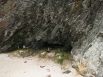
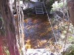
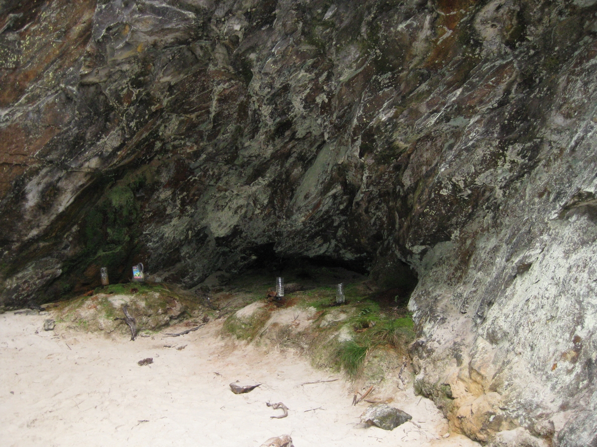
The water supply at Louisa Bay. Previous bushwalkers have left water containers to collect drips from freshwater from the roof of the cave. (click for a larger picture) |
|
|
Day 4 : Rest day at Louisa Bay. I stayed at Louisa Bay with slightly improving weather. I walked along Louisa Bay and crossed the sandbar to Louisa Island.
|
(Above) Louisa River, just before it reaches the sea at Louisa Bay (click for enlarged picture)
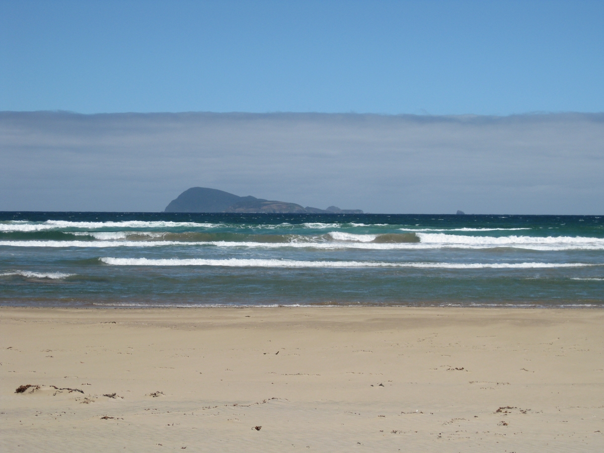
(Above) Looking out to Maatsuker Island from Louisa Bay |

(above) Sand bar that I walked across to get to Louisa Island (click for larger picture) |
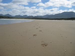
My footprints in the sand at Louisa Bay |
(above) Beach on Louisa Island (click for larger picture) |
|
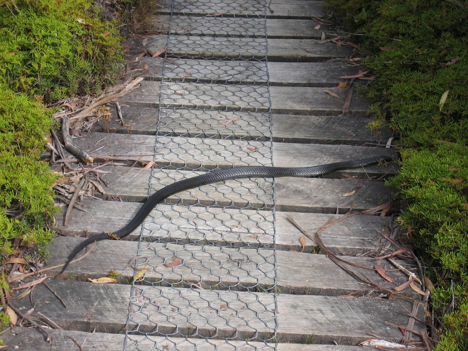
Day 5 : Louisa Bay to Louisa River. An easy day, leaving Louisa Bay later in the morning for the few kilometres to Louisa River campsite. Following the undefined track, there was a short but difficult crossing of a swamp to get back to the main south coast track. The sun came out, and so did the snakes. I was stopped by a Tiger snake sunning itself on the track . When I finally made it Louisa River campsite I set up camp only to find another Tiger Snake hanging around my campsite. However I never saw another snake the whole trip.
|
| I was too surprised to get a picture of the tiger snake I saw. However this picture from Our Hiking Blog. pretty well sums up what I saw (click for enlarged picture) > You can visit Our Hiking Blog to get some good info on how to avoid snake bite |
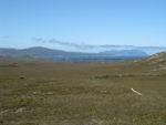
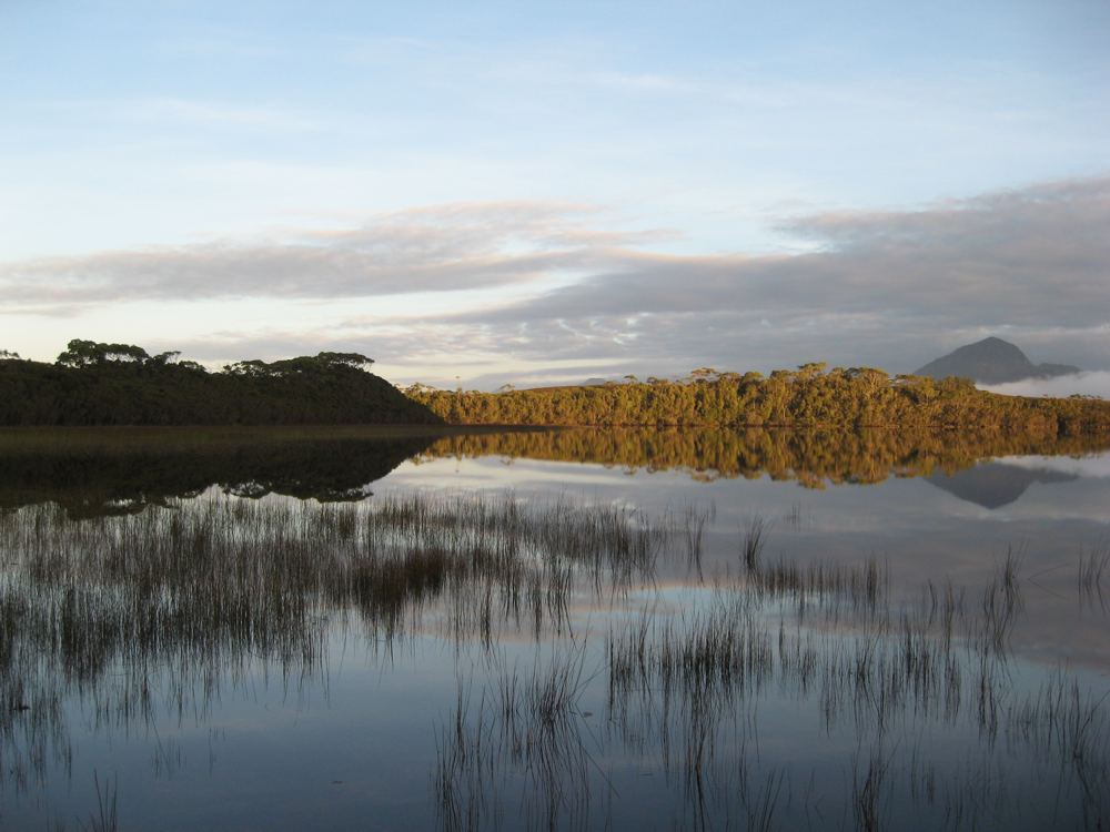
(Above) Louisa Plains with Louisa River meandering through (click for larger picture) |
|
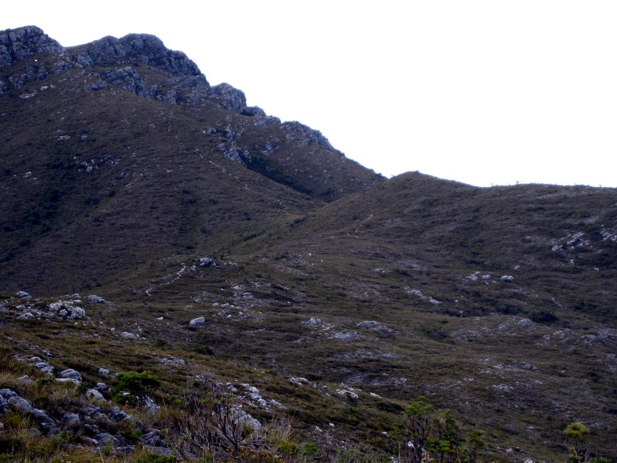
Day 6 : Louisa River to camp on Ironbound Range ridge. This was the big one, crossing the Ironbound Range. As usual I was slow getting going. However I did pass another two bushwalkers who were still packing up the other side of Louisa River. They of course passed me at speed only a little distance up the side of the range.
It goes without saying it was a long slog. Eventually I made it to the top, when it was windy. I got passed by a Queensland couple who stayed at the high camp. I met them later, and they described the campsite as good, with shelter and water. I started the slow ankle twisting descent. It was descent that needed my walking poles to brace almost ever second step. Around 6pm I decided it was time to give up, and found a small clearing on the ridge. The campsite was quite sheltered with trees, but I could hear the wind gusts blowing hard over the ridge above the trees.
|
| (Above) Climbing the Ironbound Range. Plenty of climbing left. (click for enlarged picture) |
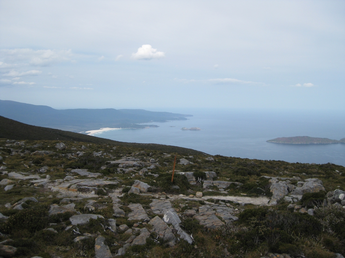
(Above) The view looking east towards Prion Beach from the top og Ironbound Range (click for larger picture) |
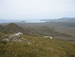
(Above) Looking back towards Louisa Bay and Red Point Hills from the Iron Bound Range |
|
Day 7 : Ironbound Range ridge to Turua Beach.(Deadmans Bay). I left early because I was low on water, and was not able to cook my porridge for breakfast. The slow descent continued. I estimated at one stage I was probably only doing 1km per hour on the descent. I crossed a creek after Ironbounds low camp, and topped up my water supplies. The descent got easier until it became a gentle slope. I passed an enormous tent at Little Deadmans Bay (I think they had come in by boat). It was a bit muddy between Little Deadmans Bay and Turua Beach. By mid afternoon it was raining on and off I decided I would stop and camp at a nice campsite at Turua Beach.
|
| (Above) Turua Beach from the campsite (click for enlarged picture) |
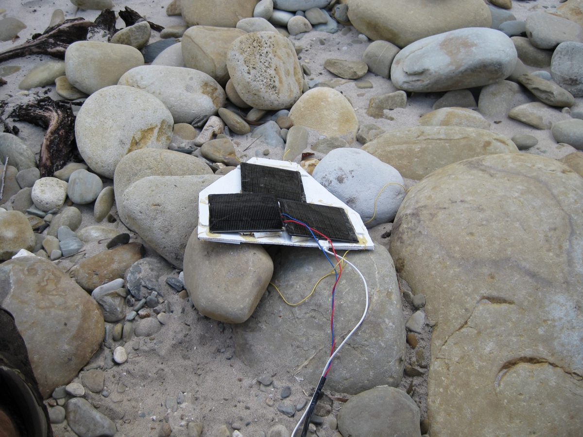
Above. Putting out my Solar Panels to charge my Pocket PC at Turua Beach. I use Oziexplorer running on an HP Ipaq 212 as my GPS. Oziexplorer allows me to scan in maps from John Chapmans South Coast Guide and use the maps on my GPS. However power is always a problem, so I need to charge whenever I see some sunlight. (click for larger picture) |
|
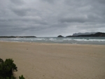
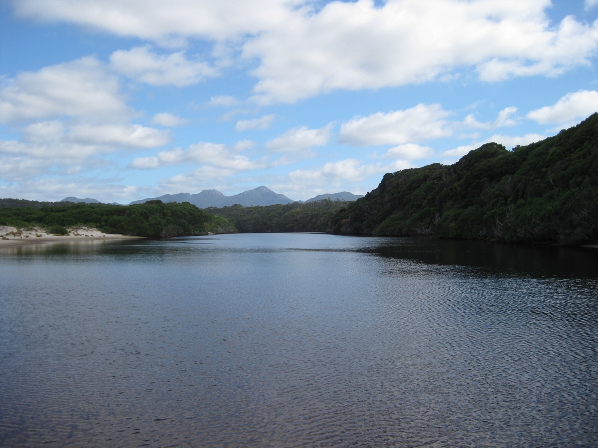
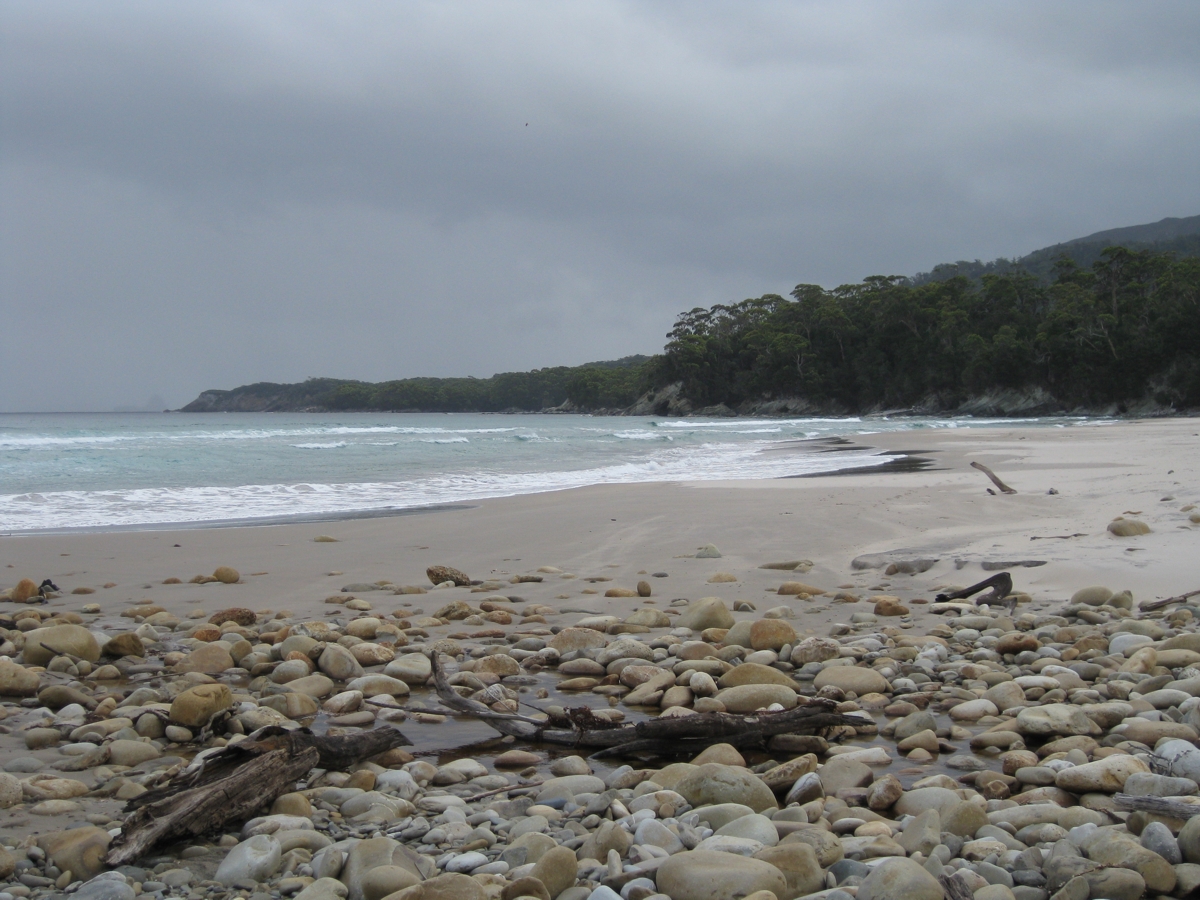
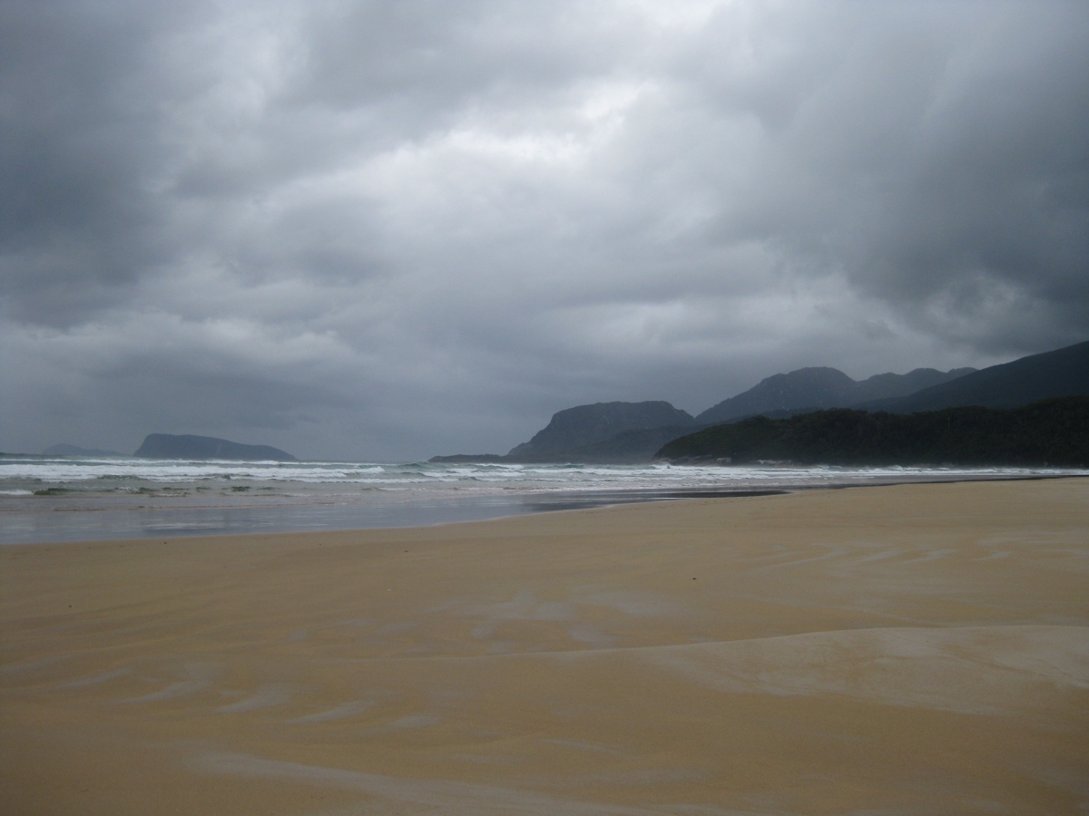
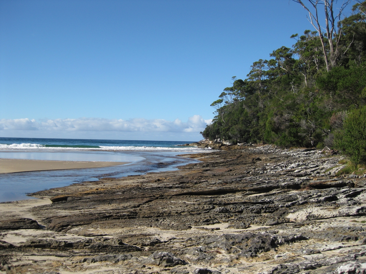
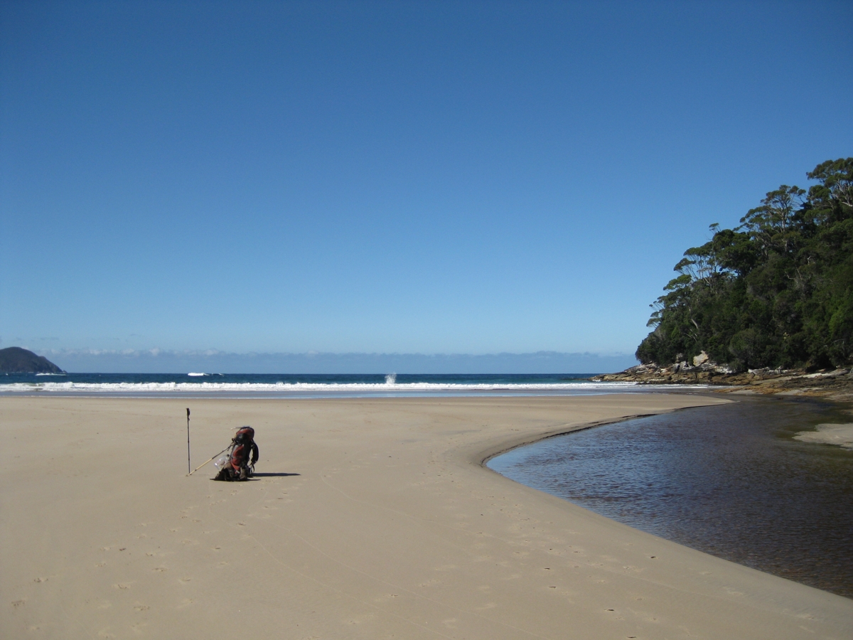
Day 8 :Turua Beach to Prion Bay- An easy day, with some rowing. Over the hill and down to Prion Beach. Scrub the boots and gaiters at the scrub station, and then a walk along Prion Beach. Eventually getting to the row boats to cross New River Lagoon. Its a much easier crossing than the Bathurst Narrows crossing (also with row boats). Walked through the scrub until reaching Milford Creek. The clouds were getting darker and darker, and it was going to rain soon. I stopped stopped and camp at Eastern Prion, on top of the sand dune. As soon as I had my tent up, it poured with rain for a couple of hours. |
| (Above) Prion Beach (click for enlarged picture) |
(above) New River Lagoon showing the row boat crossing in the distance and Prion Beach (click for larger picture) |
Campsite at East Prion, after lots of rain. |
|
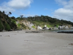
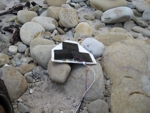
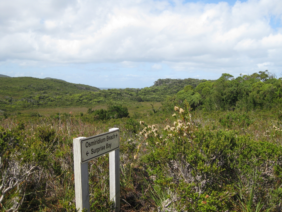
Day 9 :East Prion to Granite Beach -.I found a camera hanging on a branch not long after leaving East Prion. It had survived the rain in the night. I stopped at the intersection with the Osmiridium Beach track, and a woman came out from Osmiridium. I asked her if she had lost a camera, and she had!. A bit later 3 french women came again out of Osmiridium. They had specially come to Australia to do the South Coast walk. Camera with rightful owner, I continued over some very green hills and descended into Surprise Bay. A nice beach for lunch. Off with the boots to cross Surprise Rivulet, and then up the hill again past the campsite. I met another solo walker who was having a rest day at Surprise Bay.
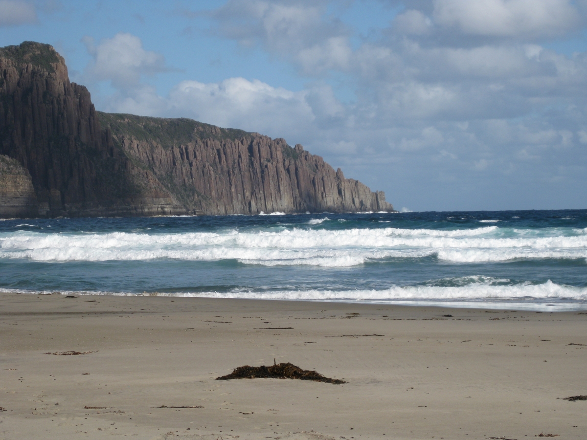
Down onto Granite Beach which was pretty hard walking. Lots of round boulders, easy to twist an ankle. I made it most of the way along Granite Beach and found a secluded campsite next to Sandstone Creek. |
| (above) The intersection at Osmiridium Beach. One of the few signs I saw on the South Coast Track.(click for enlarged picture) |

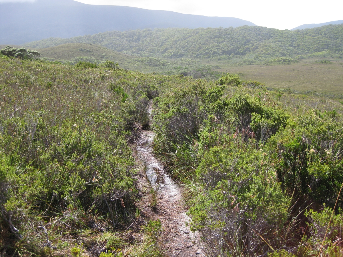
A typical section of South Coast Track. (click for larger picture) |

The Fluted Cliffs seen from Granite Beach- South West Tasmania (click for larger photo) |
|
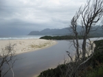
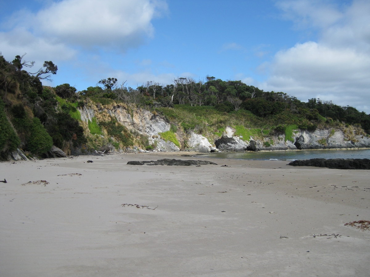
Day 10 : Granite Beach to South Cape Rivulet - A muddy track over South Cape Range. It took a long time to cover. The climb up was not too bad, but then the track was up and down, and narrow with lots of tree roots and muddy pools. There was a nice section of boardwalk at the end though. I met a bush walker along the way, who suggested than rather than the main campsite I should stay the western side of South Cap Rivulet, and it was a good campsite. At South Cape Rivulet there were a lot more people. Its only a day walk from Cockle Creek, so a lot more people make it a destination. |
| (above) Campsite overlooking South Cape Rivulet (click for enlarged picture) |

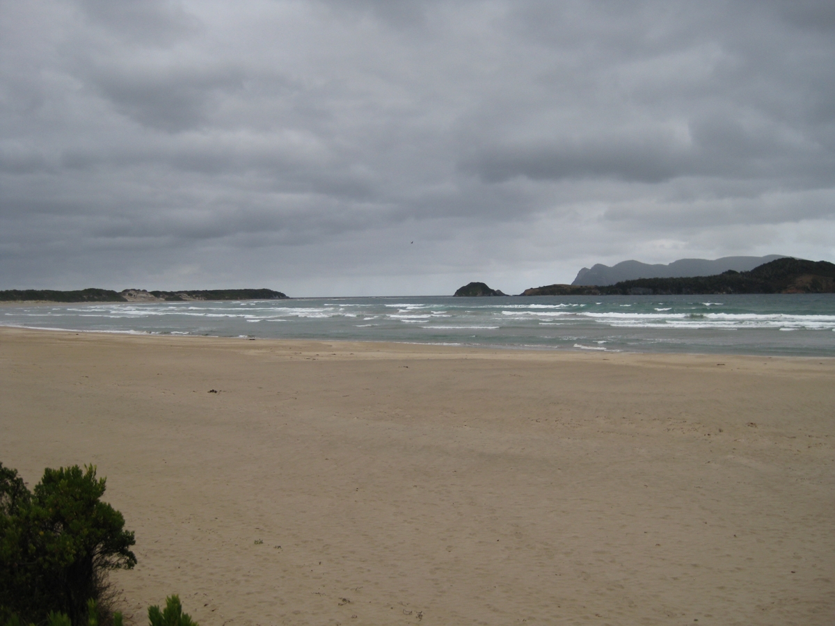
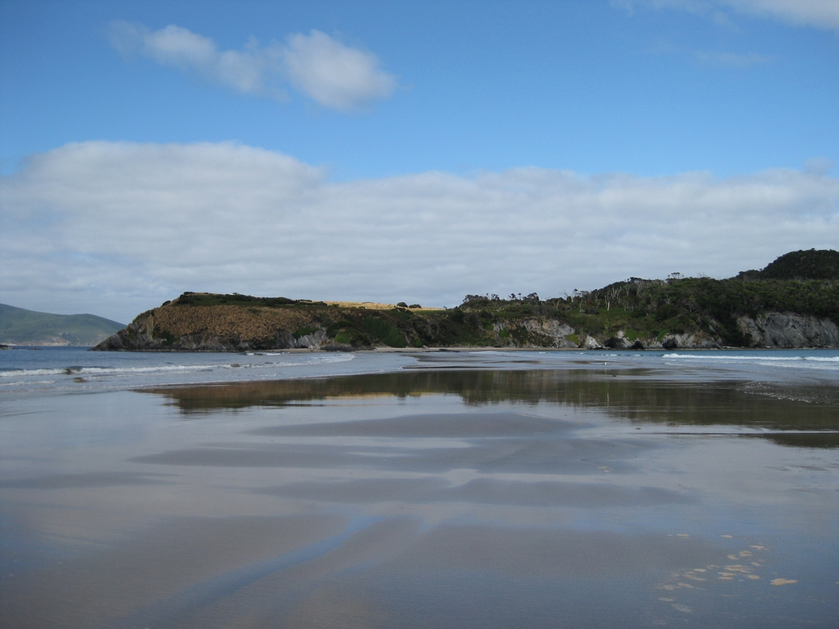
(above) The first sunny day for about a week at South Cape Rivulet (click for larger picture) |
South Cape Rivulet flowing out to sea (click for larger)
|
|
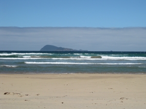
Day 11 : South Cape Rivulet to Cockle Creek - A nice sunny day for the last day walking to Cockle Creek. Lots more walkers around, including people just walking down from Cockle Creek for the day. A couple of walkers from Queensland I met, had decided to camp the last night at the Campsite just past Lion Rock, which I think was a good idea. The bus comes around lunch-time at Cockle Creek, so its plenty of time to walk to Cockle Creek in the morning. |
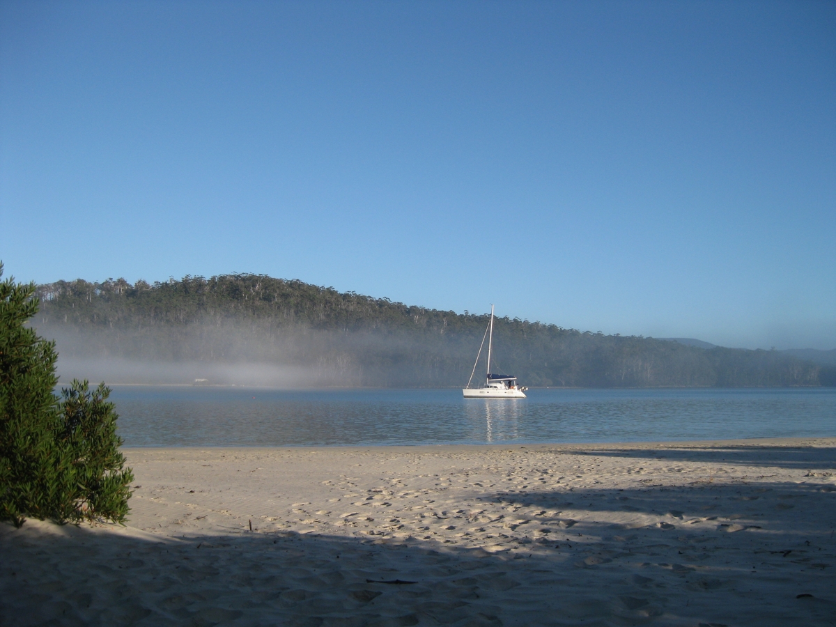
| (above) A sailing boat moored at Cockle Creek (click for enlarged picture) |
|
Bush walking the South Coast Track, South West Tasmania |


