Bush-walking the Port Davey Track South West Tasmania
February 2009 - Walked the Port Davey track from Scotts Peak Dam to Melaleuca, and then to the south coast, New Harbor and Hidden Bay. Originally my plan had been to do the Port Davey track and then continue on to the South Coast Track. This however was much more ambitious than I was capable of. I did the South coast Track the following year which you can read here.
I spent 12 days walking in South West Tasmania - from Scotts Peak Dam to Melaleuca, and then south to New Harbour and Hidden Bay (or the South-West cape circuit) and then returning to Melaleuca. (click on map for an enlarged map of my route)
Day 1: Scotts Peak to Junction Creek. I arrived at Hobart Airport on a Saturday morning and caught an Evans Coaches bus from the Airport to Scotts Peak Dam about 140km from Hobart. We stopped at New Norfolk to get fuel supplies (shellite or white gas for my MSR stove) . We arrived at Scotts Peak Dam about 2pm in the afternoon. There were 11 other bushwalkers in the bus - some heading in different directions, for example the Western Arthurs traverse.
The initial few kilometres of the track was good. Boardwalks and a well graded track (although the weather was warm). However the track started to have more muddy patches that eventually became more and more common along the whole Port Davey track. More bushwalkers are found at Junction Creek camp, as the northern end of the Port Davey track is an access point to the Western Arthurs, and many other areas of South-West Tasmania. Starting so late in the day made it hard. Even though I thought I had done lots of training, I was very tired at the end of the day.
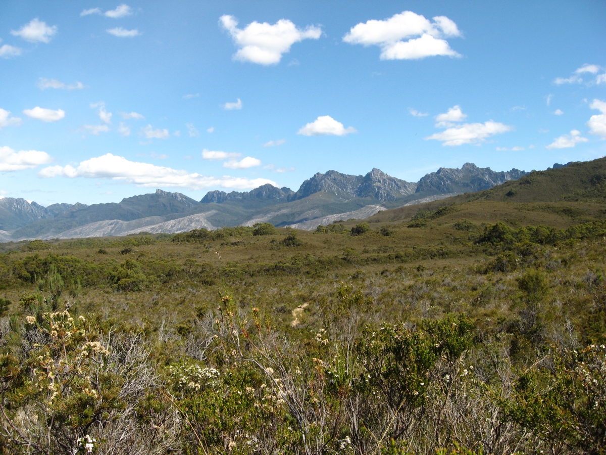
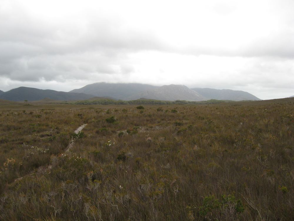
Buttongrass plains a few kilometres south of Scotts Peak on the Port Davey Track (click for enlarged picture)
Bushwakers ahead heading towards
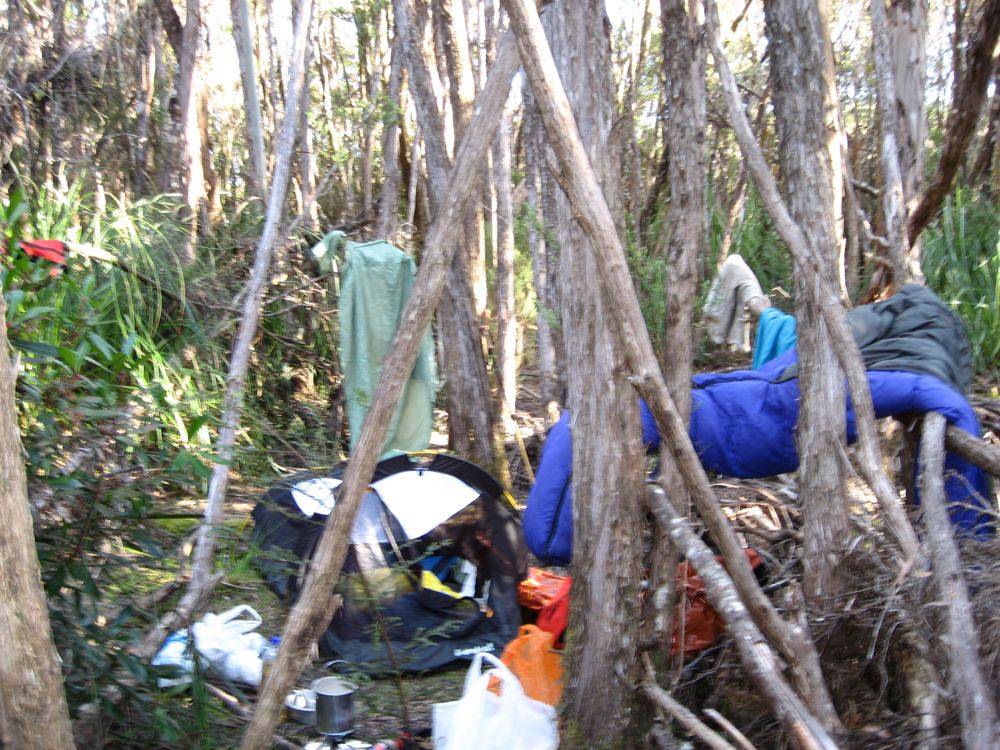
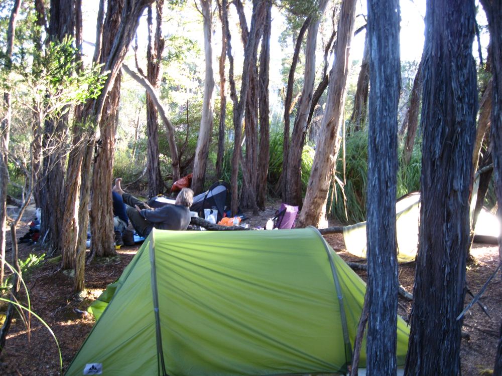
Junction Creek camp on the Port davey track (click for larger picture)
Camped at Junction Creek.
Day 2: Junction Creek to Crossing River. This was a cloudy day to start with, but became sunnier as the day progressed. Gradually you climb out of Junction river towards the Western Arthurs, passing the turnoff to Alpha Moraine. I then crossed the muddy Crossing River plains, until wading across the Crossing River to the excellent campsite.
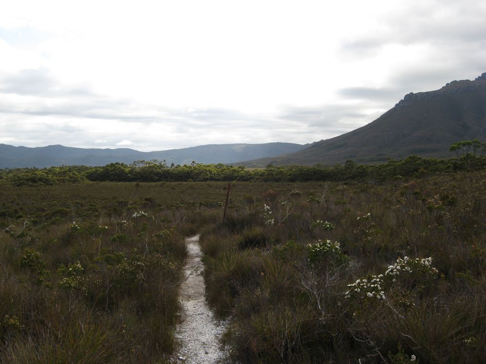
The track between Junction Creek and Crossing River (click for enlarged picture)
The Tannin stained waters of Crossing River. A great campsite and pebble beach to rest on - especially on a sunny day. If its warm enough its a great place for a swim. (click for larger picture)
Camped at Crossing River
Day 3: Crossing River to Watershed Camp. A Sunny day, with a a fair bit of mud while walking over the crossing river plains. Six of us arrived at Watershed camp, which was muddy, and we just managed to squeeze all the tents in.
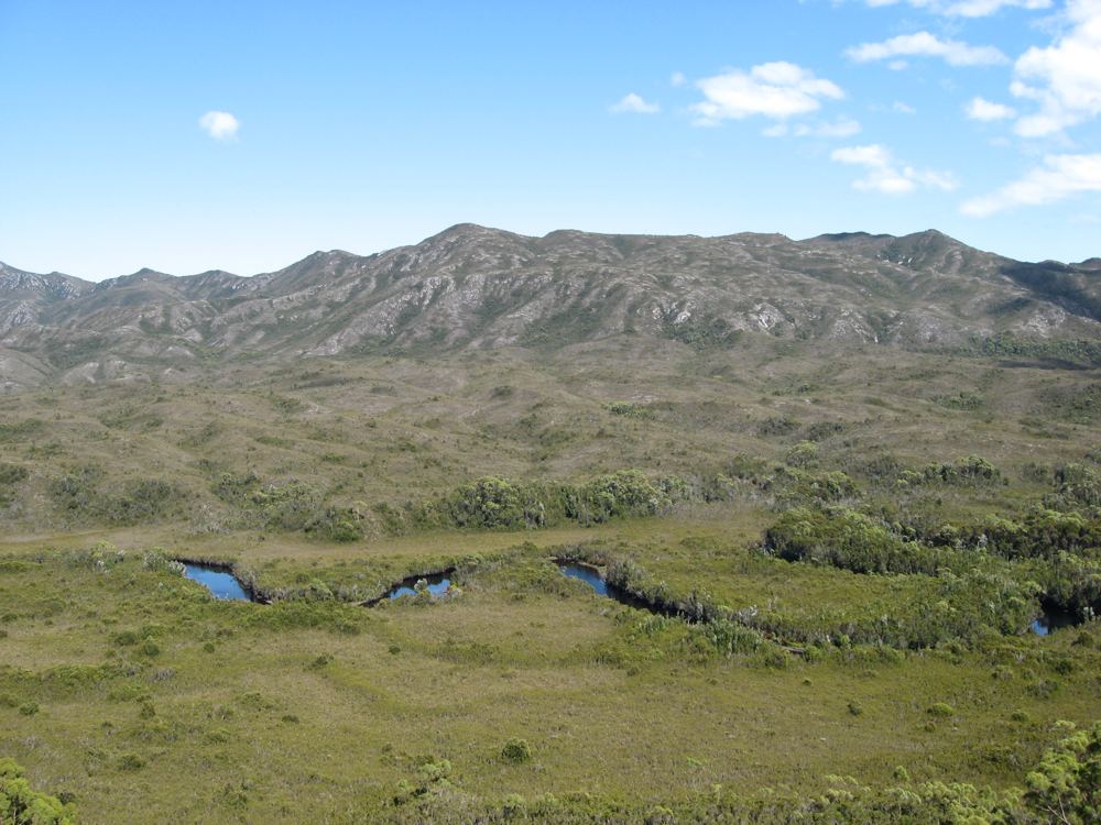
The crossing river plains(click for enlarged picture)
The Port Davey track south of Crossing River on the way to Watershed Camp (click for larger picture)
Day 4: Watershed Camp to creek near Spring River. Another Sunny day, together with Robert and Christian, two Germans also walking the Port Davey track - we made it to a campsite about 1.5 kilometres north of the Spring River camp. Lots of mud leaving Watershed camp. It was a long day.
Stopped for Lunch on the Post Davey track.(from left) Robert, Graeme,Baydon and Christian (click for enlarged picture)
Our campsite 1.5km north of the Spring River campsite on the Port Davey track (click for larger picture)
Day 5: North of Spring River to camp 5km North of Farrell Point. I attempted to make it all the way to Farrell Point, but it was a warm day. At a very small campsite 5km north of Farrell point I stopped for the day. The campsite was close to water, but only just had room for my small hiking tent. The track followed ridges up and down for most of the day, after leaving Spring River. I was trying to keep up with the two Germans Robert and Christian, but I just could not keep up. I badly needed a rest day, but I would have to put it off for another day.
A view of Spring River from the Port Davey track (click for enlarged picture)
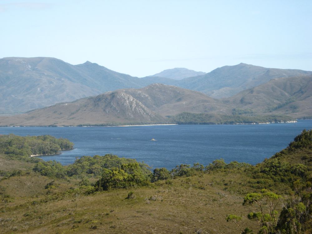
A view of Bathurst Narrows from the Port Davey track (click for larger picture)
Walking through the scrub near Spring River
Spring River - from Port Davey Track
Day 6: 5 km North of Farell Point to Horseshoe Inlet. I walked the 5km to Farrell Point, and then began the difficult task of the dingy crossing of the Bathurst Narrows by myself. The dingy are heavy, but certainly the most difficult one to launch is the dingy at Joan Point at the southern end of the Bathrust Narrows. It must have taken 2 hours in total to do the crossing, and by early afternoon the wind had picked up in the Bathurst Narrows making the crossing more difficult. After doing the crossing I walked over the ridge to Horseshoe inlet to camp and have a rest day. I believe a trip is much better if after 3 days of walking (or cycling) you have a rest day where you just lounge around. I think the whole trip is so much easier after a rest day, with your muscles recovered.
Boat launch at Joan Point southern side of Bathurst Narrows. It is a difficult launch by yourself. (click for enlarged picture)
A view of Horseshoe Inlet from the Port Davey track (click for larger picture)
Day 7: Rest day at Horseshoe inlet. Good camping sites on the eastern side of the inlet. There is no direct track from the Port Davey track to Horseshoe Inlet. It was a bit of a battle through the scrub until I found a way through. It was a nice campsite although lacking water. I picked up some water a bit further south along the shore where a creek trickled in. I would suggest if camping at Horseshoe inlet you bring enough water with you.
Camped on Horseshoe Inlet (click for enlarged picture)
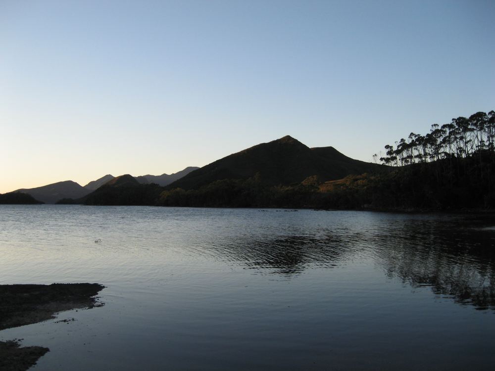
Horseshoe Inlet at sunset close to Port Davey track (click for larger picture)
Horseshoe Inlet Bathurst Narrows - Port Davey
Day 8: Horseshoe inlet to Melaleuca. A cloudy sometimes rainy day. Most of the time I walked along the plain of Melaleuca creek. I caught up with some of the walkers I had walked with earlier at the hut at Melaleuca. I found one of the German guys, Christian, who had such injured feet he could not keep walking. He left his German friend Robert to keep going. I heard later from other walkers that Robert made it all the way to Cockle Creek.
Port Davey track from Horseshoe Inlet to Melaleuca (click for enlarged picture)
Button grass plains near Melaleuca on Port Davey track (click for larger picture)
Day 9 : Melaleuca to New Harbour - South West circuit.. A another cloudy day, but no rain. The track from Melaleuca is excellent with boardwalks cover most of the track. Once the track forks towards the South-West circuit, the track gets muddy again. I camped at a campsite at the eastern end of New Harbour.
Melaleuca to Cox Bight track boardwalk (click for enlarged picture)
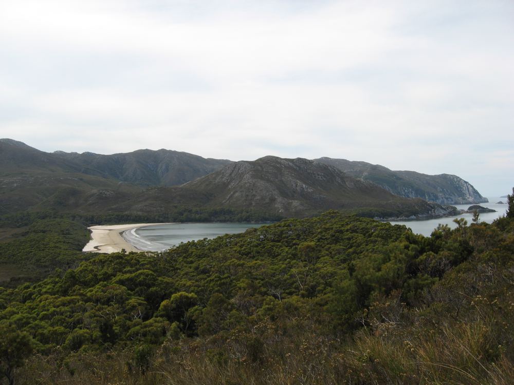
New Harbour on the South-West circuit track (click for larger picture)
New Harbour from the track going towards Hidden Bay
Day 10 : New Harbour to Hidden Bay - South West circuit.. A nice sunny day. An excellent track that has been recently upgraded. Not a long walk 2-3 hours. I decided to camp on the beach at Hidden Bay, which in hindsight was probably not a good idea. Later in the afternoon a storm came in and it was a struggle to keep dry.
New Harbour to Hidden Bay - South West Circuit (click for enlarged picture)
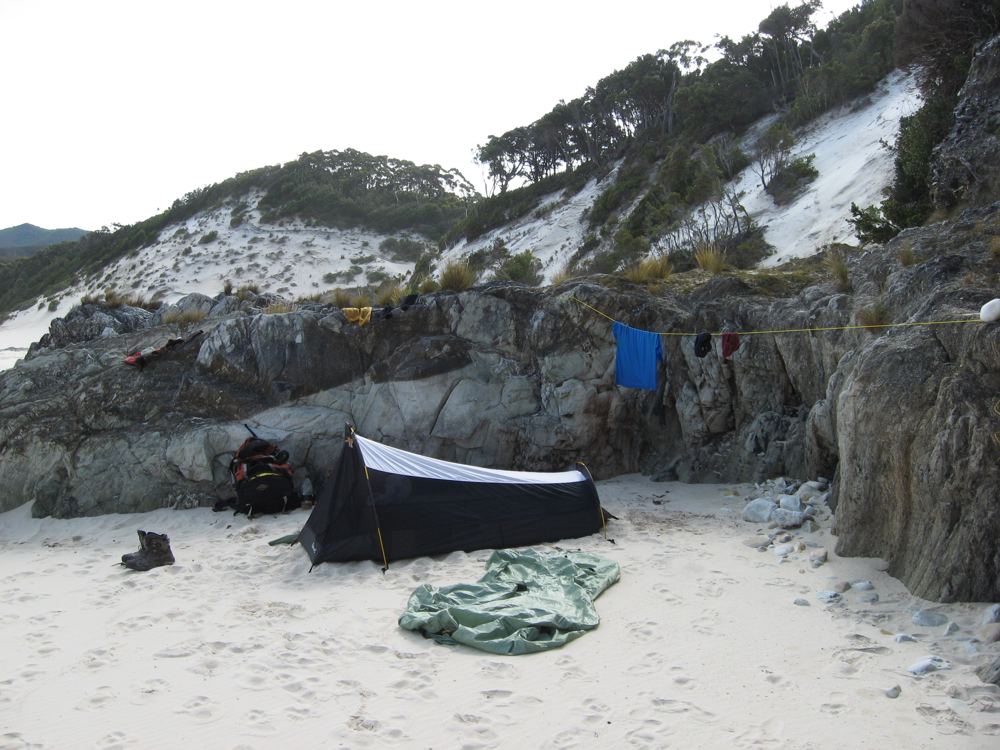
Camped on the beach at Hidden Bay on the South-West circuit track (click for larger picture)
Hidden Bay - South West Tasmania
Day 11 : Hidden Bay to New Harbour - South West circuit.. a storm came in in the early evening with lots of rain. The creeks and rivers increased in depth. I walked in the cold rain and wind back to New Harbour. I camped back at the same spot at the eastern end of New Harbour that I had the day before.
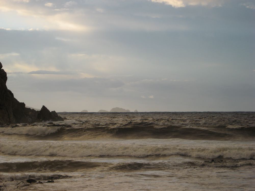
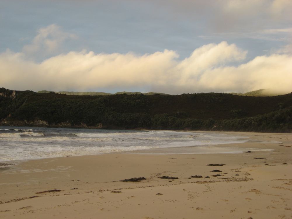
Hidden Bay after the overnight storm - South West Tasmania (click for enlarged picture)
Hidden Bay on the South-West circuit track (click for larger picture)
Waterfall after the storm Hidden Bay South-West Tasmania
Day 12 : New Harbour to Melaleuca - Walked back to Melaleuca in occasional rain.The boardwalk was underwater in several places because of the amount of rain we had received. I returned to Hobart the next morning with Par Avion
Charging my Pocket PC PDA (also GPS) with my solar panel (click for enlarged picture)
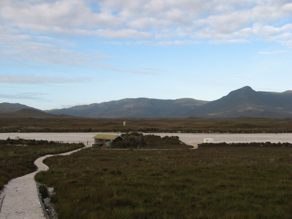
Melaleuca Airstrip South-West Tasmania (click for larger picture)
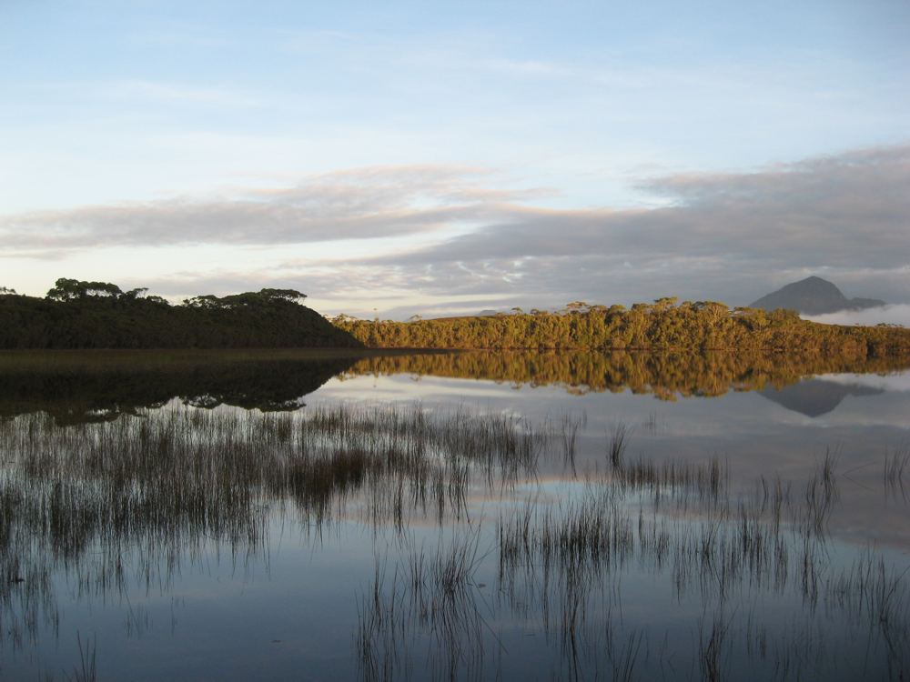
Melaleuca Lagoon at dawn
Having done now the Port Davey track and the South Coast track, I can say that the Port Davey track in some ways is harder. There are not the heights to climb over like the Ironbound range on the South Coast track, but the Port Davey track is much less developed, and much much more muddy. The Port Davey track is more isloated, and you are less likely to meet other walkers.
Ā
Bushwalking the Port Davey Track South West Tasmania