Tag Archives: national parks

Carretera Austral – Route 7

We finished driving Carretera Australia the Southern Highway last night.

Finally.

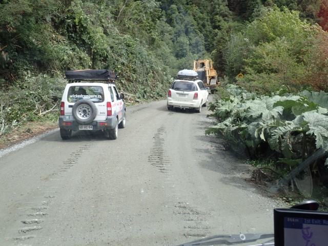
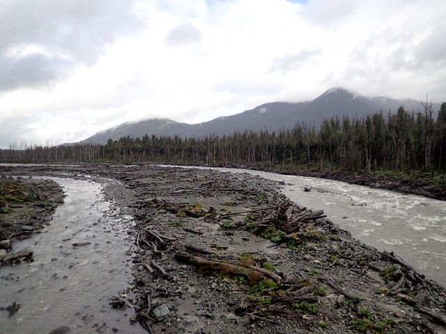
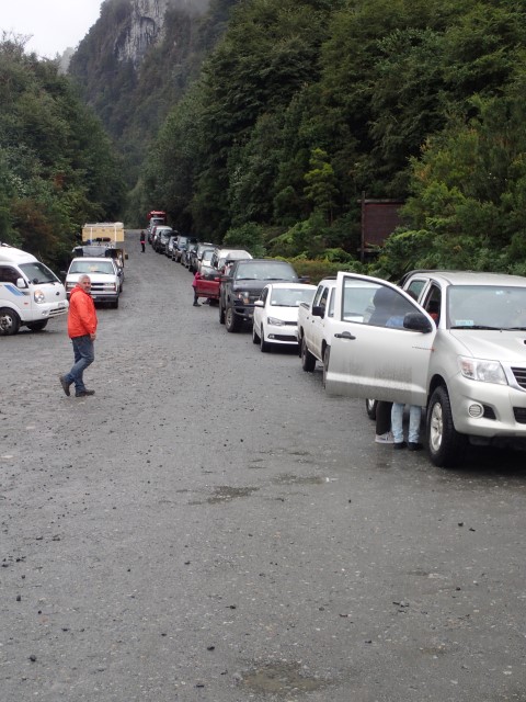
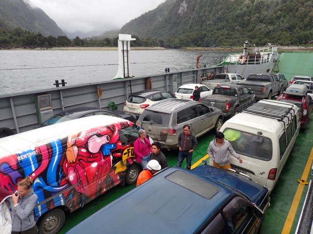
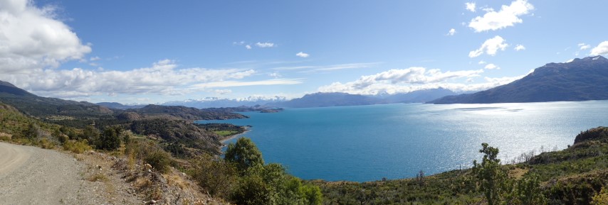
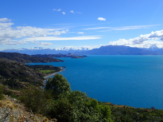
It’s been a week of rain, roadworks, long delays, rain, pot-holes, ferrys, rain, a walk through an enchanted forest to a lake and the truly beautiful Parque Pumalin. Ruta 7 is 1240kms long, but we did the first/last few hundred kms twice, down to Villa O’Higgins and back. It’s taken us 9 days to do it, including a couple of really long driving days.

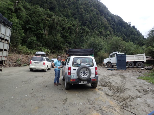
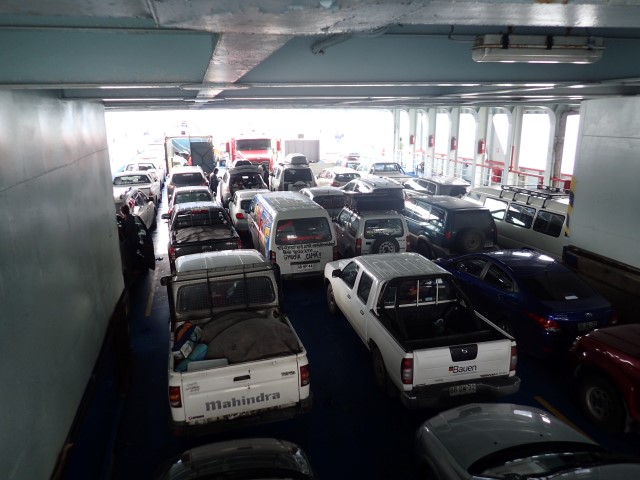
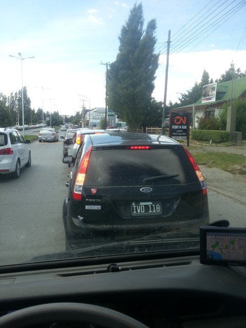
On Wednesday it took us nearly 10 hours to drive 250kms – a combination of long delays at roadworks, road in really terrible condition in places and rain. Yesterday we spent the day waiting for ferries and catching ferries, then driving the last stretch of Ruta 7 towards Puerto Montt, and finally (FINALLY!) stopped at a Copec Service Station on Highway 5 well after midnight. We ate burgers in their fast food restaurant, then parked the van in a corner near the truck parking and slept there for the rest of the night. Amazingly, we did both sleep, in spite of the lights, traffic noise from the highway and the comings and goings of the 24 hour fuel stop.

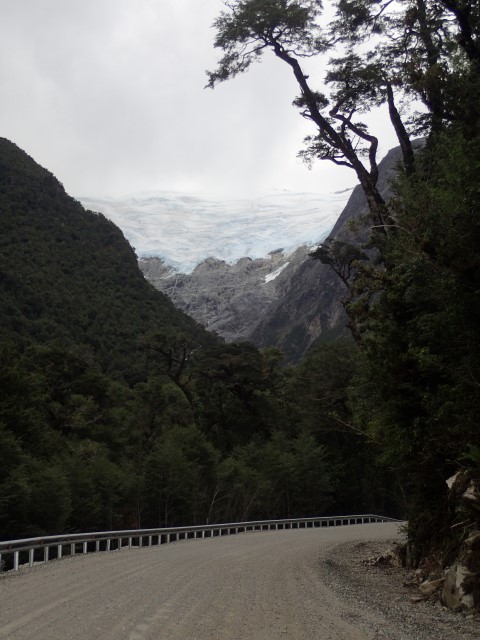
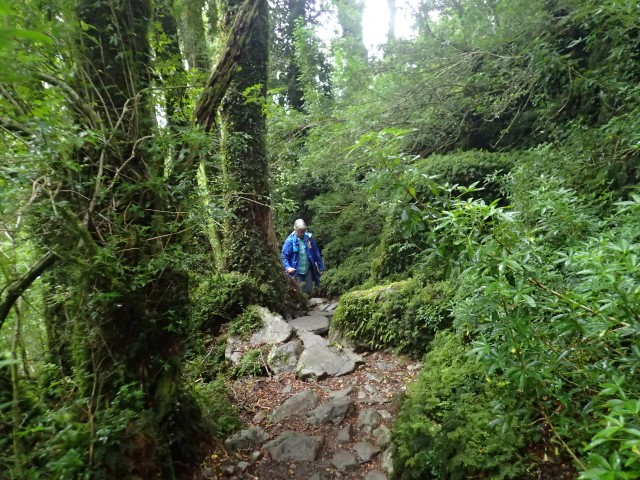
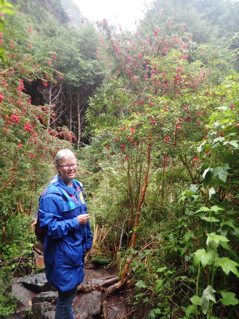
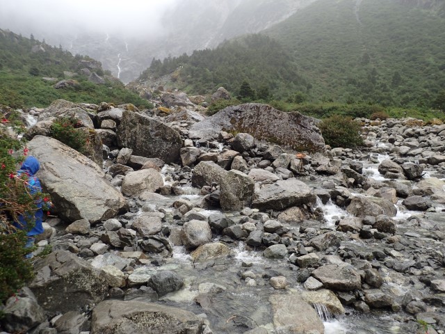
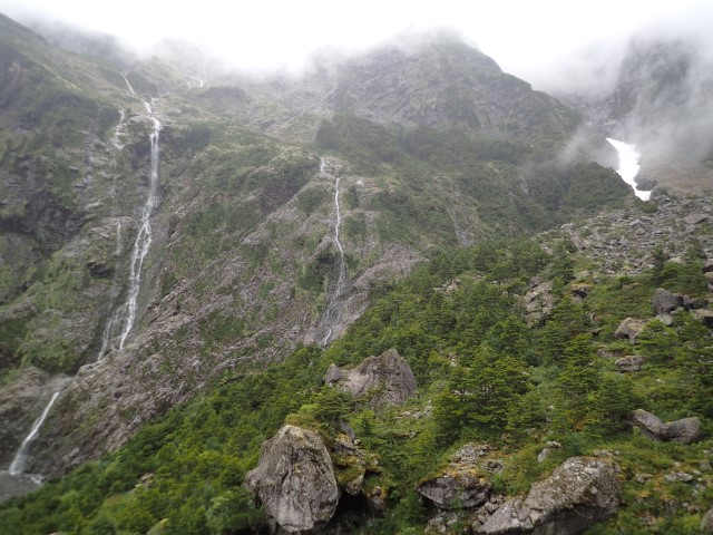
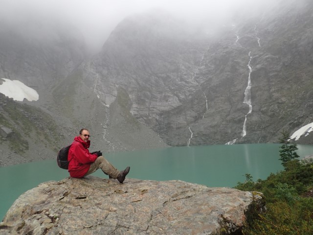
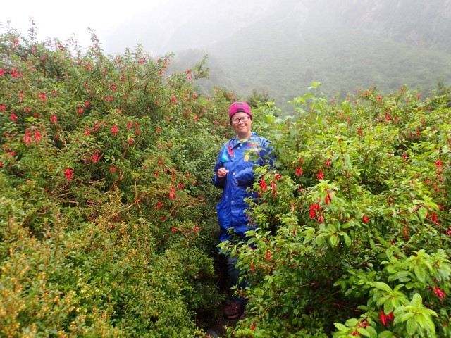
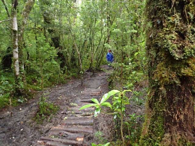
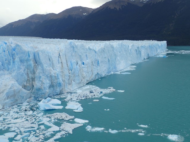
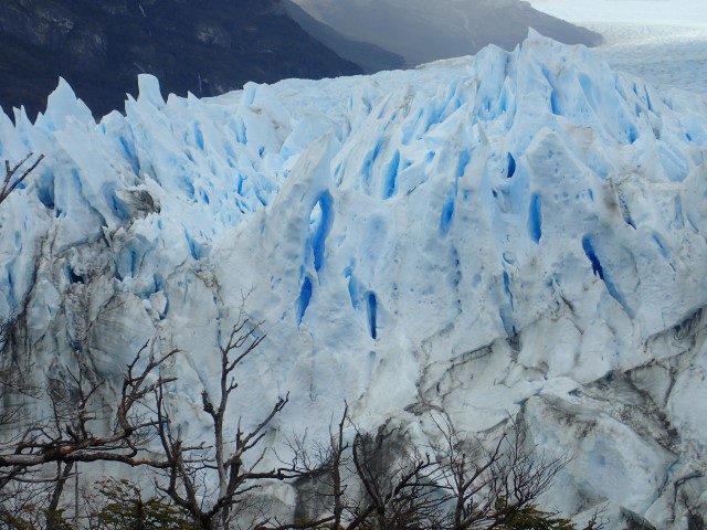
Highlights of the week were the Enchanted Forest walk we did in Queulat National Park on Wednesday, and our 2-day stay in Parque Pumalin Pumalin Park. The walk is 3kms and goes through the closest thing to Fairyland I’ve ever seen – dense rainforest full of tiny ferns, mosses, fuchsias, lichens – ending up at a glacial lake fed by several hanging glaciers and a few waterfalls. We had to cross a river and a couple of creeks by stepping on stones, and I was very impressed that we both got across and back without falling in! Parts of the trail were very muddy and a ‘path’ had been made out of sliced logs and bits of timber – it was like that game kids play, going from one place to the other without touching the ground. It rained lightly for most of the time and we were a bit wet by the time we finished the walk, 3 hours later, but we were back in the car when it really started raining, around the same time as the busload of tourists were starting off. Many of them were wearing $2 ponchos, and a few women had strappy sandals and leggings on. Negotiating their way across those river stones would be …. challenging.

Parque Pumalin is a large wilderness area that was set up by Douglas Tompkins, the US businessman who started North Face adventure gear in the 1960s, and who co-founded Esprit with his wife and one of her friends. Mr Tompkins sold his interest in the clothing company in the late 1980s and devoted his life and fortune to conserving large tracts of wilderness in Chile and Argentina, and lots more projects, which you can read about here. He died in a kayaking accident on Lago General Carrera south of Coyhaique a couple of months ago.

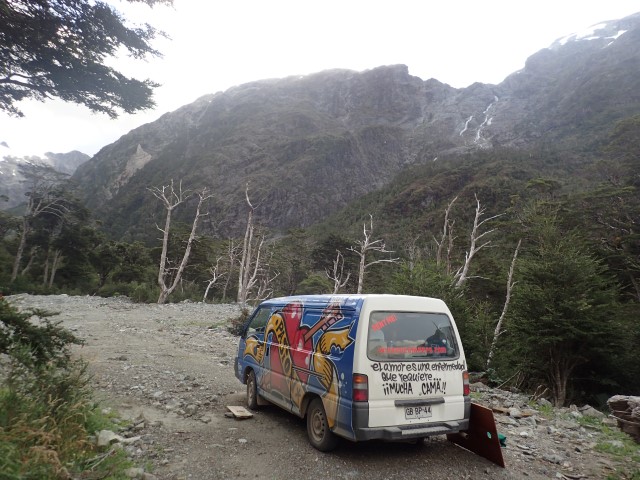
Ruta 7 goes through Parque Pumalin, and there are several campgrounds within the park. We decided to stay at Volcan Campground, which is close to Chalten Volcano. On rare clear days you can see the volcano from the campgound. It rained the whole time we were there, and most of the time the surrounding mountains were completely covered in mist, but I think I might have caught a glimpse of the volcano once. Maybe.

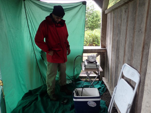
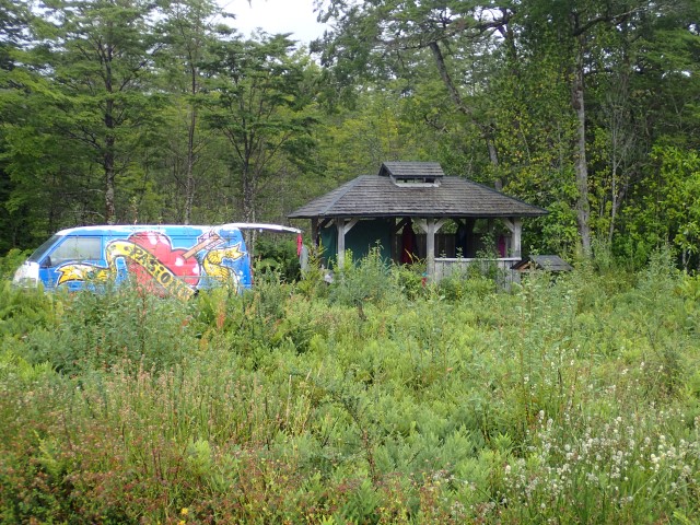
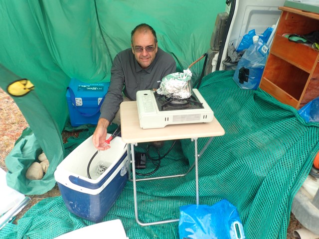
So we rolled into the campground at 10.30pm and couldn’t find any empty sites in the dark, so we sort of ‘stealth-camped’ in plain sight outside one of the toilet blocks. We found an unoccupied site the next morning and settled in. Each of the 10 or so sites has its own shelter, and there are also a couple of walk-in group sites for backpackers. The whole campground is beautifully set out, definitely the nicest place we have stayed at on this trip. Cold water showers, but we had Greg’s wonderful water heater, so we were able to have warm showers in a tarpaulin cubicle in one corner of our shelter. We did some washing, which is still drying, strung up in the van, days later!

Queulat National Park driving through
Camped at the side of the road in Queulat National Park, there was almost no traffic once it got dark
OLYMPUS DIGITAL CAMERA
Walking the Enchanted Forest walk
OLYMPUS DIGITAL CAMERA
The really large Fuchsias growing wild in the park
OLYMPUS DIGITAL CAMERA
Crossing the river Enchanted Forest walk
OLYMPUS DIGITAL CAMERA
Waterfalls Enchanted Forest walk
OLYMPUS DIGITAL CAMERA
The Enchanted lake at the end of the Enchanted Forest walk
OLYMPUS DIGITAL CAMERA
More Fuschias
OLYMPUS DIGITAL CAMERA
The somewhat muddy Enchanted Forest walk
OLYMPUS DIGITAL CAMERA
Stuck behind a Bulldozer descending a switchback. The Bulldozer was pushing the trailer of the low-loader that was carrying the Bulldozer around the corners because the corners were too sharp
OLYMPUS DIGITAL CAMERA
Waiting at more roadworks meeting the other Wicked 4WD with the Dutch girls
OLYMPUS DIGITAL CAMERA
Building the hot shower
OLYMPUS DIGITAL CAMERA
Camping at Camp Volcan
OLYMPUS DIGITAL CAMERA
One of the Rivers near the Chaiten Volcano choked with dead trees
OLYMPUS DIGITAL CAMERA
Another queue for another Ferry
OLYMPUS DIGITAL CAMERA
First Ferry for the day. Eventually it would take all day to take 3 Ferrys
OLYMPUS DIGITAL CAMERA
2nd Ferry, this time a 3.5 hour ride


Parque Nacional Los Glaciares – El Calafate

So, continuing with the ‘what we did last week’ theme, we headed out of Torres del Paine National Park through the northern entrance, which is the better road and the route all the buses take. The entrance was full of buses and people, many of whom were trying to hitch-hike.

Lots of people hitchhike in Argentina and Chile, I’m sure we’ve seen more hitchhikers in the last 3 weeks than we have seen in our whole lives! They would all love to travel with us in our cool Wicked campervan, but then they would probably all love to travel in anything as long as it gets them where they want to go. Some of the roads we’ve travelled on don’t have much traffic at all, and it could take a long time to be lucky and get a lift. We passed a couple yesterday afternoon at around 7pm on a quiet road and I thought … I hope you guys have a Plan B, ‘cos you’re probably not going to get much further tonight.

Another border crossing back into Argentina, another system to try and navigate. We thought border crossings in Africa were all a bit different, but comparing them with the Chilean and Argentinian ones, they were easy! We were heading to El Calafate, which is in the southern part of Glacier National Park, and west of Routa 40. We had to detour there a couple of weeks ago when we needed petrol. The southern part Glacier National Park is further west of El Calafate and features some truly spectacular glaciers which are easily accessible by road or boat.

But first, there was the small matter of refuelling … which seems to be a constant theme of this trip. El Calafate has 2 service stations, one at either end of the main street. The first one had a huge queue going up the street, over the bridge and around the corner – we couldn’t see where it ended. The second servo charges 10c/litre more, which seems to be a bit of a big deal for price-sensitive travellers (we’ve paid heaps more in outback Australia, and even prices between suburban servos can vary by up to 30c/litre), so we headed there, but …. Oh No! No fuel. The attendant told me that the next tanker would arrive manana in the morning, but it’s that’s fairly loose term which can also mean later, sometime, never. We went to the 2 supermarkets in town to get a few things, sat for a while and had lunch and drove past the more expensive servo about an hour later to find a queue of cars and one petrol bowser working. So we joined the queue, waited a while, refuelled (cash only!) and headed 80kms west to the National Park to see the Perito Moreno Glacier.

Wow, what a sight! It’s about 5kms wide and 14+kms long, and it’s probably the most easily-accessible glacier in the world. Well, I know it’s taken us a couple of days to fly here and a few weeks of driving, but it is possible to just fly to El Calafate, hire a car or hop on a bus, then just walk a few hundred metres down some well-constructed steps and platforms and see it in all its glory, just a couple of hundred metres away. It is absolutely magnificent! We walked the long way around, about 1.5kms of boardwalks and steps, so we started at the shorter end furthest away and made our way to the closer, taller end. It’s a tidewater glacier, running into Largo Argentina, and we listened and watched for pieces breaking off into the water.

The National Park doesn’t allow camping, so we consulted ioverlander.com and found a lovely spot just behind a small hill off the road back to El Calafate. It was windy, but Greg rigged up the shower system and a tarp and we had hot showers, then a hot meal. Perfect!

Los Antiguos – Cochrane 18.2.16

I’m going to jump ahead now beforeĀ  I forget too much. I’ll re-order some of the posts later.

The night before last we stayed in Los Antiguos, just across the border in Argentina. The municipal campground had been described in our Footprint guide book as ‘outstanding’, which seems a bit over the top, but it did have hot showers and most of the toilets had toilet seats. We found a site with power away from the very crowded tent camping area, and woke up to tents crammed on either side of us. I think we have a different perception of ‘personal space’ to the locals.

And so to, hopefully, our last border crossing ….. back into Chile. I’ve lost count of how many crosings we’ve done, but we’ll get a photo of the van’s customs papers before we give them back with the van. Loads of stamps, signatures, dates. And even though we’ve entered Chile … well, a few times … we had to fill in a piece of paper we’d never seen before!

There’s a huge lake here – called Lago Buenes Aires on the Argentinian side, and Lago General Carrera on the Chilean side. Deep, blue, icy clear water. The road from the border to Routa 7 Carretera Austral The Southern Highway goes along the southern edge of the lake and the scenery is stunning. A postcard around every bend. We could see glaciers on the mountains to the west, fed by the Campo de Hielo San Valentine Saint Valentine Icefield.

We stayed in a backyard campground last night in Cochrane on Routa 7. About 25 people in 3 vehicles & 14 tents sharing 2 bathrooms, huge queue for them this morning. The owner really needs to put in a separate toilet. We’re just waiting for a backpacker to ask us for a lift … I think we’ll need to check the van for stowaways before we leave. We’re heading 200kms south to Villa O’Higgins, which is as far south as we can get on Highway 7. There’s an American guy from Washington State here and he just came from there yesterday and told Greg that the road is good. There are glaciers there fed by the Campo de Hielo Norte Northern Icefield that we’ve seen from the Argentinian side, so we’ll hopefully get to see them from the Chilean side.

Queuing for fuel again in El Calafate. As Judy said like in Poland when you see a fuel queue join it, it might be the last fuel you see for a while
Perito Moreno Glacier
Perito Moreno Glacier closeup of blue ice and an hole
Getting our hot shower ready sheltered from the wind at the back of the van
Wild camping west of El Calafate, clothes line attached to a rock, no trees here
Drying the socks with a clothes line in the van

General Carrera Lake route 265
General Carrera Lake

Torres del Paine, Chile

So last Thursday was my birthday, and we had lunch at a parilla grill in Puerto Natales. ‘Grill’ doesn’t really translate well, it’s much more involved than just slinging bits of meat on a gas or electric-fired hotplateĀ  – parillas are restaurants that cook over open fires. The one we went to had a circular open fire where they cooked whole sides of lamb, with a hearth where the chef cooked pieces of beef and fish over the coals. We both had Patagonian lamb with potatoes and a ‘Chilean salad’ – tomatoes, sliced onions, chopped chillies and coriander leaf. All delicious, the perefect Patagonian meal, and the perfect birthday lunch.

In the afternoon, we headed north-west to Torres del Paine National Park. The road was pretty ordinary, but we’re used to that, we’ve been on a lot of crappy unsealed roads by now. We paid the admission fee plus a fairly extortionate fee ($20 per person, per night!) to camp in one of the campgrounds within the park, but the view of the Torres towers was almost worth it. Greg may not have thought so, as there was no hot water in the mens’ bathroom, even though there were 4 gas hot water systems in various statesĀ  of dis/repair. It rained overnight, but cleared the next morning and the view really was stunning. I think I’m going to run out of adjectives and superlatives to describe the places we’ve visited over the last week.

There’s a boat cruise to Grey Glacier, running 4 times a day. We missed out on the 2pm cruise, but got seats on the 6pm cruise and were really happy about that. The afternoon cruise had almost 100 people on it, but the later one that we did had just over a dozen people, which suited us just fine. In addition to providing sightseeing to the 3 arms of the glacier, the boat takes hikers to and from the starting/finishing point of one of the very popular hiking trails in the park. Loads of people hike in the park, we didn’t realise how many until the following day when we watched a boat taking about 100 hikers with gear from another launching post further north in the park.

The cruise to Grey Glacier was excellent, we were able to get close to all 3 arms of the glacier, and the guide spoke good English and was able to tell us a lot about the Torres and the glacier. We dollar-cost averaged the previous night’s expensive campsite by sleeping in the car park near where the boat was moored. Free camping is very common and acceptable in both Chile and Argentina, and easy to do, especially when it doesn’t involve a tent.

Patagonia lamb cooking

Judys lunch of Patagonian Lamb
The towers of Torres del Paine
Parked in front of Torres del Paine on a sunny day
Never getting bored of looking at the mountains
The old blue ice of Grey Glacier
On the boat approaching Grey Glacier
Inside after being out in the cold
Trekking in Torres del Paine is not a wilderness experience. The queue of 50+ trekkers for just one of the 4 boats a day that take them to the start. There are shops, cabins and more along the route
A windy snowy day up on Torres del Paine


A quick update

No, we haven’t fallen off the edge of the earth, or down a crevasse in a glacier, we’ve spent the last week in and near national parks in Chile and Argentina, getting as close as we could to glaciers in Torres del Paine in Chile, and Glacier National Park in Argentina.

We’ve had no power and no internet, hence the lack of posts. We’re camping at the municipal campground (power! hot water! clotheslines! not much wind!) at Los Antiguos tonight, and will cross the border back into Chile tomorrow. Ugh, another border crossing! But possibly our last, if we can get on the ferry we’re hoping to catch in a week or so.

The internet is pretty slow, so I’ll make this short and try and get everything we’ve done in the last week down ‘on paper’ (okay, in a .txt file) so we can update the blog later when we have better internet.

Our plans from here are to head south again, on the Chilean side, to see all the cool stuff we’ve spent the last week looking at on the Argentinian side – we’re planning on going to Villa O’Higgins, which is annoyingly close to where we were in El Chalten a couple of days ago. Only a country border and the Andes in the way.

Okay, adios amigos, see you when we have better internet.