I woke up to heavy dew and fog. I dawdled getting going because the tent and everything else was wet. However I could not put it off any longer, and I set off in the fog.
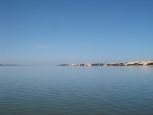
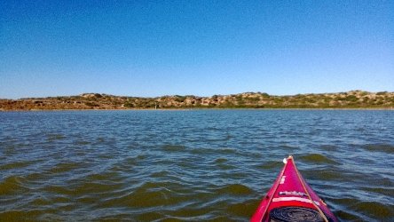
The fog was so thick that as soon as I got far enough out for it to be deep enough for the kayak I could no longer see the shore. So it was very strange paddling along on the flat calm coorong through fog, occasionally seeing birds. An hour later the fog disappeared in just a few minutes.
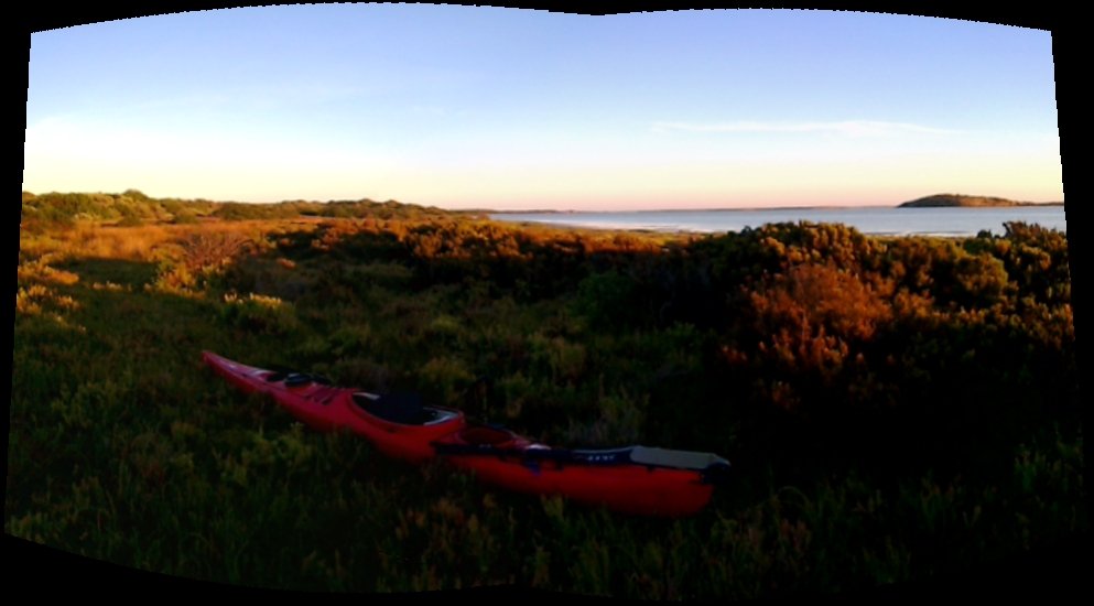
I continued on in full sunshine on a mirror calm coorong. Eventually I arrived at my campsite opposite Salt Creek.
My early start was foiled by a non-working mobile phone. It was a damp morning with lots of dew. I got going by 8:30 am and after some initial easterly winds it settled down to a fabulous day. I covered 17km before the afternoon sea breeze started at 12:30pm, but it was not that strong.I am only 7km from Salt Creek.
I saw no boats. I have not seen any other boats for 3 days.
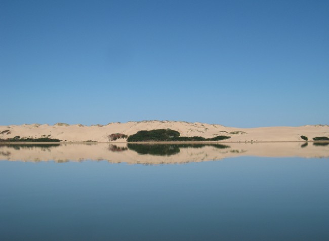
The southern coorong is different from the northern part. The bird life is different. In the northern coorong there were hundreds of black swans, while in the south I have not seen any. There are less pelicans as well.
Improved weather this morning. I got through Hells Gate quite easily. I was worried about currents and wind which might make it very difficult. It was all good, and I got through with no problems. The great weather continued and I faced a gentle headwind. I got past Cow Island and Long island (which is shorter than Cow Island).
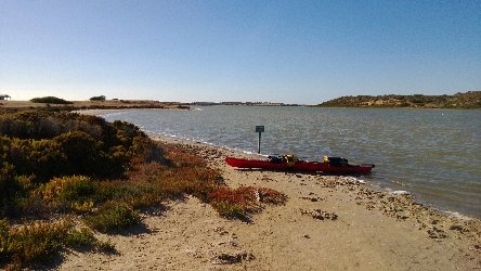
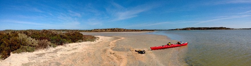
Then the wind changed and became a strong headwind dropping my speed to 2-3 kmh. I struggled across the coorong to the peninsula side. I decided it was too strong to battle against, and I would get up early tomorrow and try and get going early in the morning calm, and cover as much distance before the afternoon sea breeze started. I am 30 km away from Salt Creek, I hope to get there Saturday Night.
I am 2km south of Mount Anderson. I only managed 10km today measured straight line via the GPS, but I probably did more weaving between islands. It was very windy, with me sometimes pushing into 40cm waves. I progressed slowly stopping for a rest on goat island,which didn’t have any goats.
However it might have been cool, but it was my first sunny day, with all the cloud gone by lunchtime The cool weather has been good minimizing my water consumption, so my water supplies are still good
I gave up at 4;30pm because I was almost at Hells Gates, and I would have to do another 4km before I would be able to camp. Its all very shallow here, I had to walk the kayak a couple of times, however I did see my first boat in 2 days.
Another cold and wet day. I struggled south against the headwind but did not get as far as I hoped. I wanted to get close to Hells Gate which is a narrowing of the Coorong that separates the North and Southern parts of the Coorong. I wanted to try getting through Hells Gate in the morning, but it looks (if the wind stays the same) that I will not be able to get there until
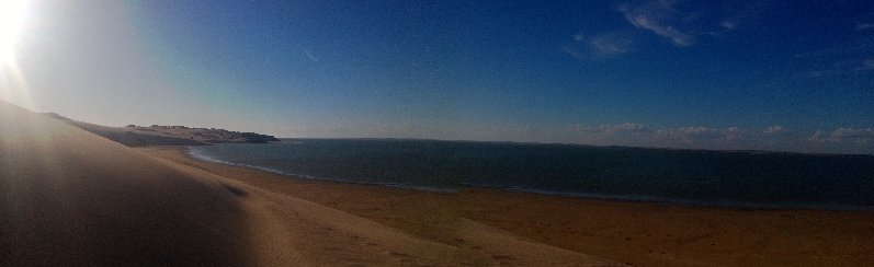
the afternoon. Part way along I stopped to look for the “Teak Wreck” which is meant to be the remains of a 400 year old shipwreck. All I found was a galv gate. However I did walk through to the ocean beach.
My arms were too tired so it was time for a rest day. It has been a cloudy day, but the sun did come out a bit in the afternoon. I had a look around Lambert Point (I am camped about 300 metres south). The guidebook I have says that some of the survivors of the Maria were buried there. The Maria was shipwrecked at Cape Jaffa in 1840. The survivors walked along the coorong ocean beach but were killed by the local aboriginals. Some of the bodies are supposed to be buried at Lambert Point, but I could not find anything.
It rained for a lot of last night. When I woke up it was still drizzling. I had breakfast in the tent and packed up between showers. I headed south into a headwind, however I had the spray deck on and was reasonably warm and dry. Every point I pass has a large number of pelicans standing around seemingly doing nothing, while the black swans and ducks are out in the water looking for food. The sun came out so I stopped to charge up some batteries with the solar panels on the side of a sand dune.
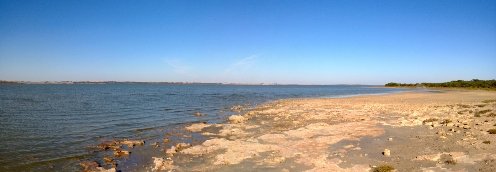
After a charging session the cloud cover returned, and I headed south against the wind. I became grounded a couple more times having to walk the kayak into deeper water. There are more reefs. The reefs are like huge lumps of coral that appear in shallow water.
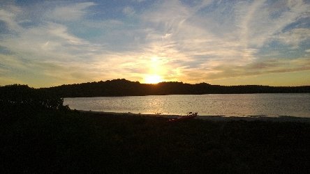
I found a nice secluded valley in the dunes again covered in grass (which I think is couch) which made a great camp site.
Pelicans taking it easy on the shallows at the end of a point
Topping up the batteries with the solar panels. It has been so cloudy for days I have not been able to charge batteries.
It’s been a cold overcast day, with rain a couple of times. The tide had gone out so it was difficult to drag the kayak back to the water. I paddled across the coorong to look at the Tauwitchere barrage. Water was flowing out of the barrage so Lake Alexandria must be reasonably full. When I got to the southern end of the barrage I found a seal trying to get something from underneath the water.
I continued south, but got grounded on shallow sections that were too shallow even for the kayak. It looked strange to be 500 metres out into the coorong walking in ankle deep water. There are still a few sailboats around mored on the Young husband peninsula side. It must be difficult for the yachts when I am having trouble in the kayak.
I stopped for lunch on a little beach, and then pushed on a couple more hours. I camped on another sheltered grassy camps site. I am fairly tired with sore arms. Hopefully tomorrow will be easier.
There were lots and lots of boats on the water around Hindmarsh Island. The area around the Murray mouth also had some tricky currents, and the ocean waves made it partway into the mouth. Once I got to the other side of the mouth I beached the kayak and fixed the rudder.
It was easier going after that. I was sheltered behind the sand dunes, and having a working rudder made it easier to paddle straight. As I was carrying 18litres of water I did not have much spare room, the excess stored in a deck bag on the hull behind me. Unfortunately the deck bag also caught the wind pushing me off course.
The boats continued, with water skiers flashing past 20 metres away, leaving me to travel through their wake. I stopped again at Geoffrey’s Landing where there were a few people camped with their ski boats, as there are toilets there. I continued paddling on and finally left most of the boats. I passed mosquito bay, and then ran into another bunch of yachts and fishing boats all bunched together in a small area, some with tents camped on the shore. The next inlet was marked on the map as shallow so with the advantage of a kayak that will float in very shallow water I headed to shore to find a camp site. The edge was a bit marshy but further in was soft grass that had been nicely grazed by the kangaroos. There are a lot of large Kangaroos around here that I don’t every remember seeing before in the coorong.


Recent Comments