Some information about Lake Eyre in outback South Australia
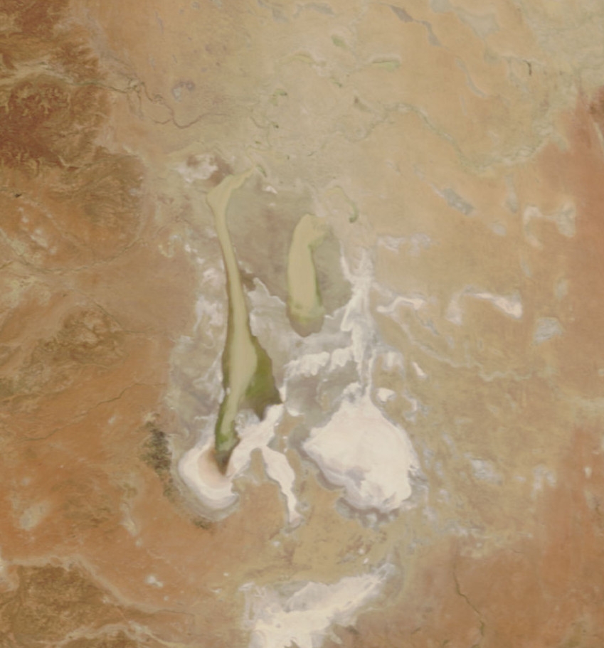
The lake was named after Edward John Eyre who was the first European to sight it in 1840. The lake is located in the deserts of central Australia, in northern South Australia. The Eyre Basin is a large endorheic system surrounding the lakebed, the lowest part of which is filled with the characteristic playa salt pan caused by the seasonal expansion and subsequent evaporation of the trapped waters. Even in the dry season there is usually some water remaining in Lake Eyre, usually collecting in a number of smaller sub-lakes on the playa.
During the rainy season the rivers from the northeast (in outback Queensland) flow towards the lake through the Channel Country. The amount of water from the monsoon determines whether water will reach the lake and if it does, how deep the lake will get. Since 1885 this has occurred in 1886/1887, 1889/1890, 1916/1917, 1950, 1955, 1974-1976 , with the highest flood of 6m in 1974. Local rain can also fill Lake Eyre to 3-4m as occurred in 1984 and 1989. Wave built shingle terraces on the shore suggest that during the Medieval Warm Period and centuries immediately prior Lake Eyre possibly held permanent water at levels above those of 1974. Torrential rain in January 2007 took about six weeks to reach the lake but put only a small amount of water into it.
When recently flooded the Lake is almost fresh and native fresh water fish, including boney bream (Nematolosa erebi), the Lake Eyre Basin sub-species of golden perch (Macquaria ambigua) and various small hardyhead species (Craterocephalus spp.) can survive in it. The salinity increases as the 450mm salt crust dissolves over a period of six months resulting in a massive fish kill. When over 4m deep the Lake is no more salty than the sea and salinity increases as the water evaporates with saturation occurring at about 500mm depth. The Lake takes on a "pink" hue when saturated due to the presence of beta-carotene pigment caused by the algae Dunaliella salina.Typically a 1.5 m (5 ft) flood occurs every three years, a 4 m (13 ft) flood every decade, and a fill or near fill four times a century. The water in the lake soon evaporates with a minor and medium flood drying by the end of the following summer.
|


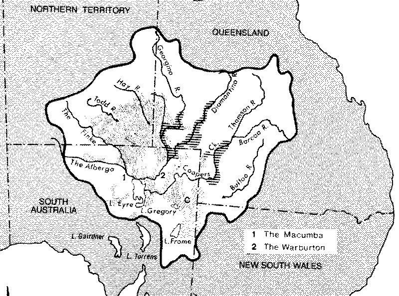 Rivers Flowing into Lake Eyre - The Lake Eyre basin.
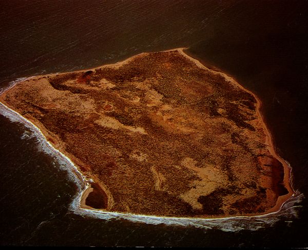 An island in Lake Eyre during the 1974 Flood, the biggest flood in the last 100 years in Lake Eyre
 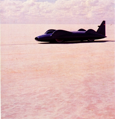 Donald Campbell on the salt on Lake Eyre in 1964 - we set a world speed record at the time of 650 km